Добавить любой RSS - источник (включая журнал LiveJournal) в свою ленту друзей вы можете на странице синдикации.
Исходная информация - http://www.360cities.net/. Данный дневник сформирован из открытого RSS-источника по адресу http://www.360cities.net/rss/rss.xml, и дополняется в соответствии с дополнением данного источника. Он может не соответствовать содержимому оригинальной страницы. Трансляция создана автоматически по запросу читателей этой RSS ленты. По всем вопросам о работе данного сервиса обращаться со страницы контактной информации.[Обновить трансляцию]
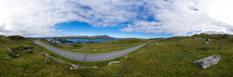
360° panorama by Gary Davies. Click the image to open the interactive version.
Loch Eport is a sea loch on the east side of North Uist. North Uist is a rugged landscape of fresh and salt water lochs located in the centre of the group of Islands known as the Outer Hebrides, off the west coast of Scotland.
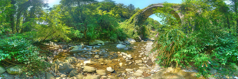
360° panorama by Massimo Storari. Click the image to open the interactive version.
A few hundred meters from Castiglione in Garfagnana, we found this place by chance. It is a bridge with a single donkey saddle arch, made with local stones. Due to its construction characteristics it should date back to the 14th century, probably contemporary with the mule-track road to Chiozza, built by Spinetta Malaspina. Just down from the bridge where the hiking trails begin, there is a building, now in ruins, perhaps built as a guard post for the control of travelers and the collection of tolls or taxes.The bridge overlooks the Esarulo river whose waters were used for the mills. In the 1400s and 1500s, along its course there were ironworking workshops that used hydraulic power to move the "mallet", a heavy hammer to strike the iron.In times of flood, the inhabitants flocked in large numbers along the river to take the trunks or tree logs carried by the waters. They used sticks with hooks to bring them closer to the shore and to those who could not catch immediately, they threw stones on them. Then , they returned at a later time to collect the timber stopped by the stones that they considered already owned.It is a very suggestive, restful and refreshing place as the river is suitable for swimming! A nice break during the excursion to Castiglione in Garfagnana, on a hot August afternoon.
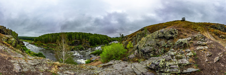
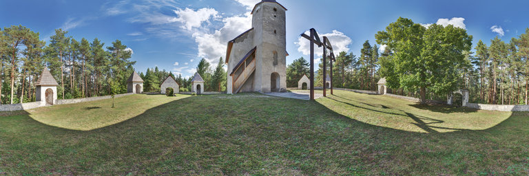
360° panorama by Massimo Storari. Click the image to open the interactive version.
A few hundred meters from Castiglione in Garfagnana, we found this place by chance. It is a bridge with a single donkey saddle arch, made with local stones. Due to its construction characteristics it should date back to the 14th century, probably contemporary with the mule-track road to Chiozza, built by Spinetta Malaspina. Just down from the bridge where the hiking trails begin, there is a building, now in ruins, perhaps built as a guard post for the control of travelers and the collection of tolls or taxes.The bridge overlooks the Esarulo river whose waters were used for the mills. In the 1400s and 1500s, along its course there were ironworking workshops that used hydraulic power to move the "mallet", a heavy hammer to strike the iron.In times of flood, the inhabitants flocked in large numbers along the river to take the trunks or tree logs carried by the waters. They used sticks with hooks to bring them closer to the shore and to those who could not catch immediately, they threw stones on them. They then returned at a later time to collect the timber stopped by the stones that they considered already owned.It is a very suggestive, restful and refreshing place as the river is suitable for swimming.A nice break during the excursion to Castiglione in Garfagnana, on a hot August afternoon.
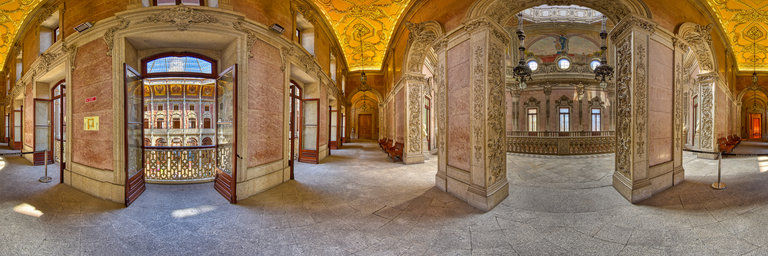
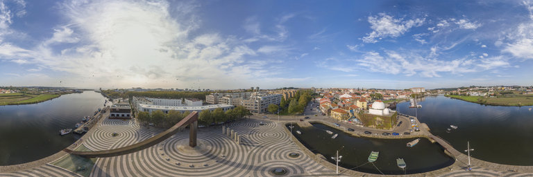
360° panorama by Santiago Ribas - 360portugal. Click the image to open the interactive version.
This square is a poetic evocation of the Discoveries, to which Vila do Conde is closely linked. An intervention by the sculptor Jos'e Rodrigues, the square is completed with several references to the Discoveries, highlighting the patterns that reflect the Portuguese presence in the «five games of the World».