Добавить любой RSS - источник (включая журнал LiveJournal) в свою ленту друзей вы можете на странице синдикации.
Исходная информация - http://www.360cities.net/. Данный дневник сформирован из открытого RSS-источника по адресу http://www.360cities.net/rss/rss.xml, и дополняется в соответствии с дополнением данного источника. Он может не соответствовать содержимому оригинальной страницы. Трансляция создана автоматически по запросу читателей этой RSS ленты. По всем вопросам о работе данного сервиса обращаться со страницы контактной информации.[Обновить трансляцию]
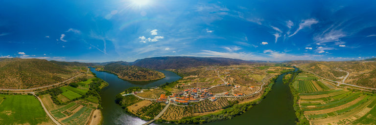
360° panorama by Santiago Ribas - 360portugal. Click the image to open the interactive version.
Here we are at the mouth of the Rio Sabor, which is a tributary of the Douro River. It is the parish Cabeca Boa, with 428 inhabitants, which is located between mountains and overlooks the valley of Vilarica and the Douro River, in the extreme west of the municipality. The settlement of this place dates back to prehistoric times. It has 4 attached places: Cabeca de Mouro, Cabanas de Cima, Cabanas de Baixo and Foz do Sabor. In this village, the traditional buildings of Cabeca Boa should be highlighted. Equally interesting are the Matriz Church of Cabeca Boa, the chapel of Santa Catarina and the chapel of Nossa Senhora do Ros'ario.
360° panorama by Santiago Ribas - 360portugal. Click the image to open the interactive version.
The Lousa, is located on an extensive plateau, 800 meters high, to the west of the municipality on the right bank of the Douro River, delimiting the municipality of Moncorvo to the west with that of Carrazeda de Ansi~aes. Integrated in the Douro Demarcated Region and partially in the area classified as World Heritage. It has two distinct microclimates, the mountainous area is identified with Tr'as-os-Montes where granite, cold and snow abound in winter, and next to Rio Douro is identified with the Alto Douro Wine Region, where shale is striking and productions abound in olive oil, generous wine and almonds. At night it is interesting to observe this village from a distance, due to its altitude, it seems to be hovering in the air
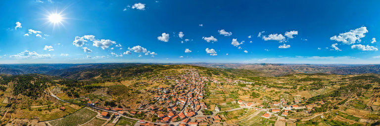
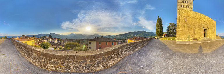
360° panorama by Massimo Storari. Click the image to open the interactive version.
The Cathedral of Barga stands on a very particular place, facing Monte Forato, a relief on the top of which stands a rocky spur that erosion has modeled in the shape of an arch. This opening means that twice a year, the spectacle of the double sunset occurs, the perfect alignment of the sun with the buttresses of Monte Forato: when the sun in its apparent motion sets behind the Forato, a second flash of light finds a new passage to irradiate the Lucca part of the Apennines for a short period. Even today, the inhabitants gather and party to admire this natural phenomenon.The Cathedral of San Cristoforo in Barga is a Romanesque jewel in the highest part of the center of the village which, on the outside, almost resembles a fortress. The original building dates back to before the year 1000 but was modified in the following centuries, with decorative elements ranging from Romanesque to Gothic. The panorama on the roofs and on the surrounding mountains , in this August afternoon , is beautiful.
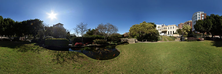
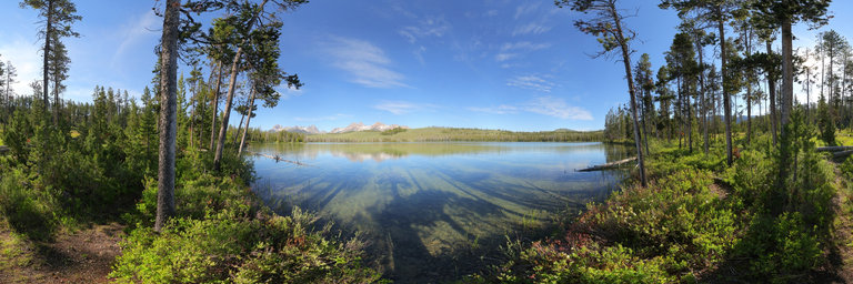
360° panorama by Kent Johnson. Click the image to open the interactive version.
This reserves was part of the gardens of Elizabeth Bay House. After the property was aquired by the City of Sydney in 1948, the 'Reserve' garden was designed by Ilmar Berzins with European and oriental influences. There are stricking views of Sydney Harbour out to the Heads and of the house itself. More details can be found on the City of Sydney website.
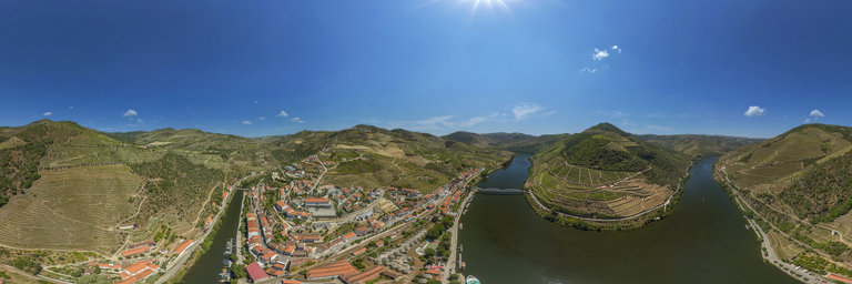
360° panorama by Santiago Ribas - 360portugal. Click the image to open the interactive version.
Traveling on the Douro Historic Train is a journey through time. On a route along the Douro River, the steam locomotive and the 5 historic carriages travel the distance from R'egua to Tua, in a unique trip to the past, marked by the beauty of the landscape classified by UNESCO as World Heritage.
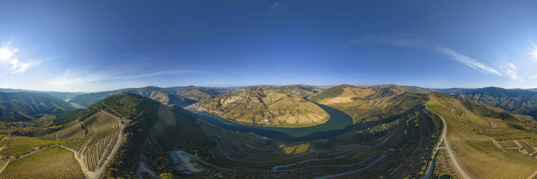
360° panorama by Santiago Ribas - 360portugal. Click the image to open the interactive version.
Foz do Tua is a small village in Portugal on the right bank of the Douro river, near the town of Carrazeda de Ansi~aes, in the Braganca district. It is surrounded by some of the most beautiful and important farms in the Douro Valley - Quinta do Tua, Quinta dos Aciprestes and Quinta dos Malvedos
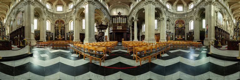
360° panorama by flaviodmt76. Click the image to open the interactive version.
Grimbergen Abbey is a Premonstratensian monastery in Grimbergen, Flemish Brabant, Belgium, established in 1128 in the place of an earlier foundation of Augustinian Canons.The abbey itself was dissolved in 1796 in the aftermath of the French Revolution, but the abbey church of Saint Servatius survived as the parish church of Grimbergen. After the French Revolution the abbey was reinstated. The building in its present form dates from 1660. It was elevated to the status of basilica minor in 1999. https://en.wikipedia.org/wiki/Grimbergen_Abbeyphoto: Voigtlander 12mm original size 17000x8500www.abagontheroad.com
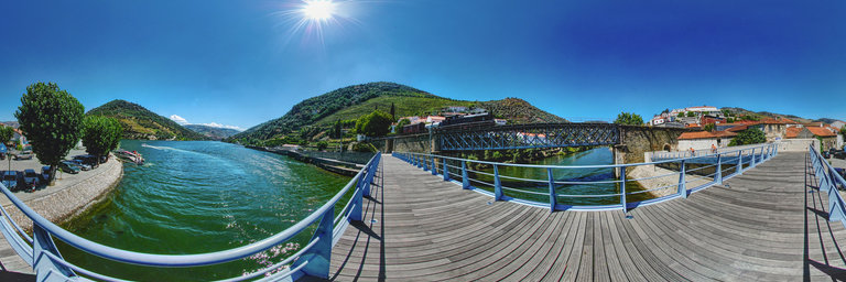
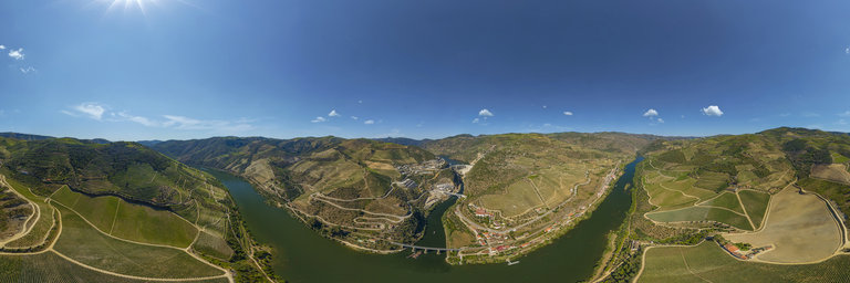
360° panorama by Santiago Ribas - 360portugal. Click the image to open the interactive version.
The village of Pinh~ao is located on the north bank of the Douro River, being the center of the demarcated region of Port Wine and the place where several estates producing generous wine are located. This town enjoys a privileged location on the right bank of the Douro River. The village of Pinh~ao receives around 400 thousand tourists per year.
360° panorama by Santiago Ribas - 360portugal. Click the image to open the interactive version.
Quinta das Carvalhas is a property of great beauty and spectacularity, with a predominant position on the slope of the left bank of the Douro River in Pinh~ao, which extends along the slopes of the right bank of the affluent Rio Torto. The oldest written references about the Quinta date back to 1759, with its magnificent Vinhas Velhas, of post-phylloxeric plantation, reaching the respectable age of a century. This magnificent property covers an area of 600 hectares, comprising 120 hectares of vineyard interspersed with beautiful forests, Mediterranean scrub and centuries-old olive groves. Its privileged location provides breathtaking views of the region, also offering a private panoramic road with access to the top of the mountain where the famous Casa Redonda is located.
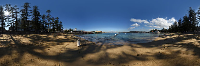
360° panorama by Kent Johnson. Click the image to open the interactive version.
The art deco Manly wharf with its white and blue clock tower,the netted swimming enclosure at Manly Cove, Sydney Harbour from the beach with pine trees of Fairlight Walk behind. Sydney Ocean Pools series.
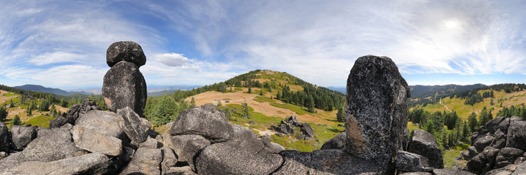
360° panorama by William l. Click the image to open the interactive version.
Standing between the Rabbit Ears just west of Mt. Ashland, Oregon. They consist of two granite outcroppings w/ even a balanced rock. Here one has good views of the Rogue Valley, Roxy Ann Peak, & Mt. McLoughlin to the south. The parking area is for the Time Warp Trail, which runs past this formation along the crest.