Добавить любой RSS - источник (включая журнал LiveJournal) в свою ленту друзей вы можете на странице синдикации.
Исходная информация - http://www.360cities.net/. Данный дневник сформирован из открытого RSS-источника по адресу http://www.360cities.net/rss/rss.xml, и дополняется в соответствии с дополнением данного источника. Он может не соответствовать содержимому оригинальной страницы. Трансляция создана автоматически по запросу читателей этой RSS ленты. По всем вопросам о работе данного сервиса обращаться со страницы контактной информации.[Обновить трансляцию]
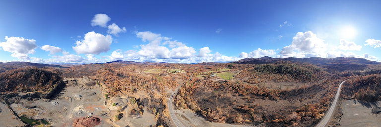
360° panorama by William l. Click the image to open the interactive version.
A 400' aerial view of the South Obenchain Fire burn area along the Butte Falls Highway near Shady Cove, Oregon. The fire ignited on September 8, 2020 near South Obenchain Road near Lakecreek, Oregon & tore through the foothills, destroying about 90 structures & burning 32,671 acres. This is a dry area throughout the summer, consisting of grass, buckbrush, scrub oak, & pine. In this view, there are no visible structures burned however one can see several along the highway.
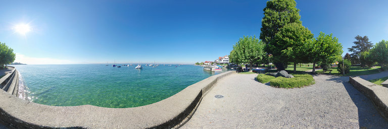
360° panorama by Klaus Mayer. Click the image to open the interactive version.
Lake Constance from the Lake Promenade in Hagnau. Hagnau is a small village on the northern shores of Lake Constance between Meersburg and Immenstaad.
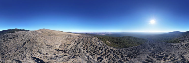
360° panorama by William l. Click the image to open the interactive version.
A 400' aerial view over Glass Mountain obsidian flow as it slowly poured down the mountainside. The flow lies at the eastern end of the Medicine Lake Caldera in California. Glass Mountain consists of a large pile of obsidian that erupted around 900-1000 years ago from 13 different vents. The obsidian varies from familiar black shiny outcroppings to obsidian froth. Most obsidian is found within the edges of the flow while the interior as well as much of the top of Glass Mountain itself is comprised of dacite. No rock collecting allowed.
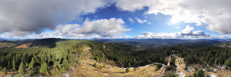
360° panorama by William l. Click the image to open the interactive version.
Aerial view (200' high) from the top of Fredenburg Butte (elev. 4,320') near Butte Falls, Oregon. The peak has been lightly dusted w/ the first snow of the season, & without the clouds one could see a good view of the Sky Lakes & Mount McLoughlin to the east, glistened in white. Also views of Obenchain Mountain & Geppert Butte area, the Rogue Valley, & Olson Mountain to the north. While this spot is marked as Fredenburg Butte, it is merely a false summit, part of a long ridge of Olson Mountain w/ other named features such as Santiam Peak, Dudley Mountain, & Round Mountain. The summit had been used as a lookout site for fires since 1918 w/ a cupola-style lookout house constructed around 1920. A more permanent lookout was built in 1935 but had been removed since 1969.
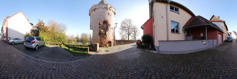
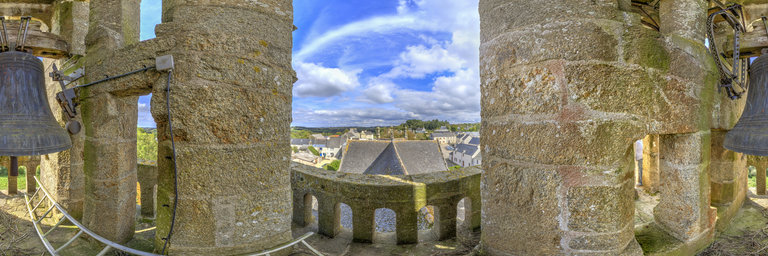
360° panorama by Ackermann, Michael. Click the image to open the interactive version.
Eines der "altesten Bauwerke Seligenstadts ist der Pulverturm. Auf Veranlassung des Klosters wurde er 1462 als Nord-Westliche Eckbefestigung der Stadtmauer errichtet. Bis ins 16. Jahrhundert wurde der "Mulaul", wie der Turm von den Einheimischen auch genannt wird, als Munitionslager genutzt. Ab 1598 diente er als Gef"angnis. Sein schickes "Aussere ist den Vereinen der Stadt zu verdanken, die sich finanziell an der umfangreichen Sanierung beteiligten. Micha
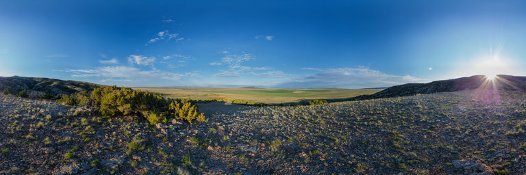
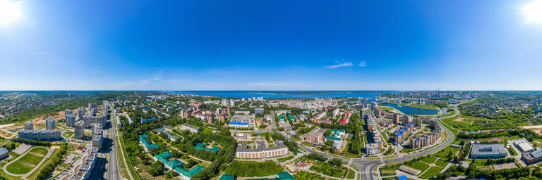
360° panorama by Ken Stahley. Click the image to open the interactive version.
In 2015 I learned that a large windfarm was destined to be built across Bowler Flat as a renewable energy project. I knew the landscape would change forever so I set about to take several panoramas from Big (West) Pryor Mountain to capture the views as I remembered them. The windfarm was completed in late 2020 and I will capture a few panoramas for the comparison of before and after.
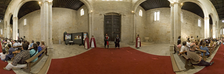
360° panorama by Santiago Ribas - 360portugal. Click the image to open the interactive version.
The Monastery of Leca do Balio also hosted the only royal wedding outside the capital, considered, over the centuries, as "cursed". On May 15, 1372, King D. Fernando married D. Leonor de Teles, an episode whose historical recreation we see here. Neighboring the mouth of the river Leca, about a league north of the historic center of Porto, it is an original example of fortified religious architecture. Religious, Romanesque and Gothic architecture. Fortified, oriented hospitable church, with a longitudinal plan of three naves of four sections, with inscribed transept, tripartite, staggered head, and quadrangular bell tower adjoining the main facade.
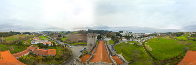
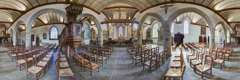
360° panorama by Santiago Ribas - 360portugal. Click the image to open the interactive version.
Neighboring the mouth of the river Leca, about a league north of the historic center of Porto, it is an original example of fortified religious architecture. Religious, Romanesque and Gothic architecture. Fortified, oriented hospitable church, with a longitudinal plan of three naves of four sections, with inscribed transept, tripartite, staggered head, and quadrangular bell tower adjoining the main facade.
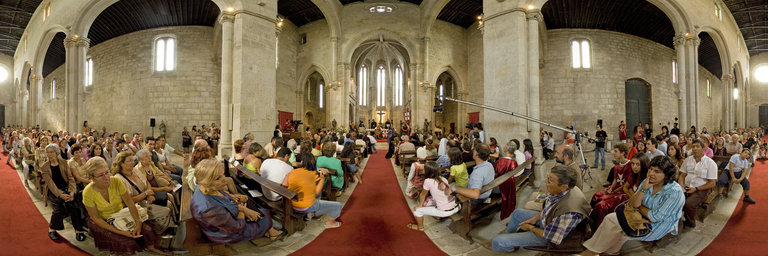
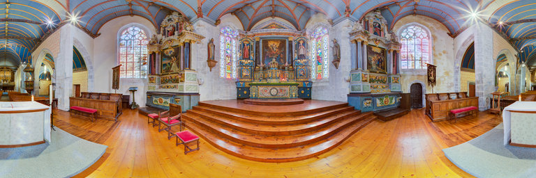
360° panorama by Santiago Ribas - 360portugal. Click the image to open the interactive version.
The Monastery of Leca do Balio also hosted the only royal wedding outside the capital, considered, over the centuries, as "cursed". On May 15, 1372, King D. Fernando married D. Leonor de Teles, an episode whose historical recreation we see here. Neighboring the mouth of the river Leca, about a league north of the historic center of Porto, it is an original example of fortified religious architecture. Religious, Romanesque and Gothic architecture. Fortified, oriented hospitable church, with a longitudinal plan of three naves of four sections, with inscribed transept, tripartite, staggered head, and quadrangular bell tower adjoining the main facade.