Добавить любой RSS - источник (включая журнал LiveJournal) в свою ленту друзей вы можете на странице синдикации.
Исходная информация - http://www.360cities.net/. Данный дневник сформирован из открытого RSS-источника по адресу http://www.360cities.net/rss/rss.xml, и дополняется в соответствии с дополнением данного источника. Он может не соответствовать содержимому оригинальной страницы. Трансляция создана автоматически по запросу читателей этой RSS ленты. По всем вопросам о работе данного сервиса обращаться со страницы контактной информации.[Обновить трансляцию]
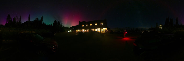
360° panorama by Jean-Louis Jondot . Click the image to open the interactive version.
Continuez votre balade des lacs vers le lac du Carrelet en passant par le lac Lamat.
360° panorama by Jean-Louis Jondot . Click the image to open the interactive version.
Continuez votre balade des lacs vers le lac du Carrelet en passant par le lac Lamat.
360° panorama by Jean-Louis Jondot . Click the image to open the interactive version.
Continuez votre balade des lacs vers le lac du Carrelet en passant par le lac Lamat.
360° panorama by Jean-Louis Jondot . Click the image to open the interactive version.
Continuez votre balade des lacs vers le lac du Carrelet en passant par le lac Lamat.
Понедельник, 19 Августа 2024 г. 23:29
+ в цитатник
360° panorama by Carpe Drone. Click the image to open the interactive version.
Aerial drone shot taken in front of the San Zeno church during a sunny day, with very good light conditions for photography. You can view the valley and Lugano airport as well.
Понедельник, 19 Августа 2024 г. 22:43
+ в цитатник
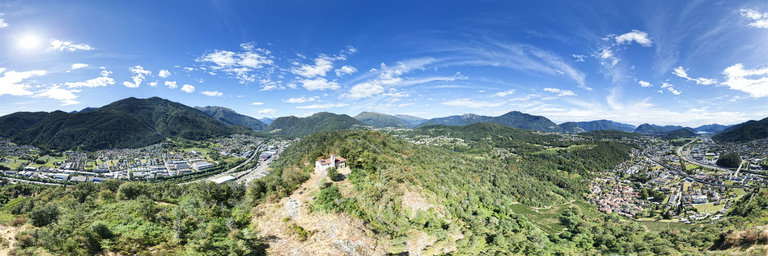
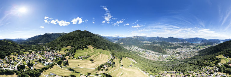
360° panorama by Carpe Drone. Click the image to open the interactive version.
Aerial drone shot taken over Arosio during a sunny day, with very good light conditions for photography. You can view the valley, notice also Lugano Airport.
Понедельник, 19 Августа 2024 г. 22:43
+ в цитатник
360° panorama by Carpe Drone. Click the image to open the interactive version.
Aerial drone shot taken over Arosio during a sunny day, with very good light conditions for photography. You can view the valley, notice also Lugano Airport.
Понедельник, 19 Августа 2024 г. 22:28
+ в цитатник
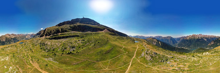
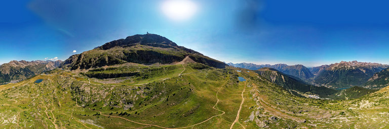
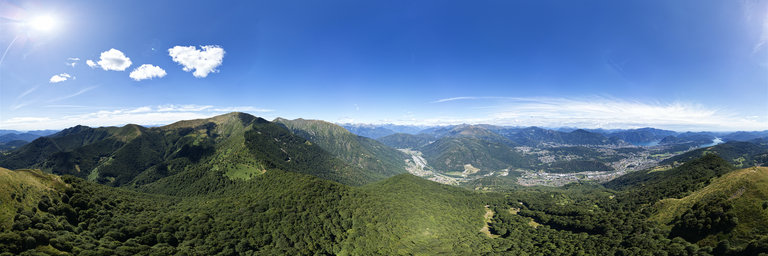
360° panorama by Carpe Drone. Click the image to open the interactive version.
Aerial drone shot taken on the Northern side of Mount Ferraro during a sunny day, with very good light conditions for photography. You can view the valley and far away till Lugano.
Понедельник, 19 Августа 2024 г. 22:28
+ в цитатник
360° panorama by Carpe Drone. Click the image to open the interactive version.
Aerial drone shot taken on the Northern side of Mount Ferraro during a sunny day, with very good light conditions for photography. You can view the valley and far away till Lugano.