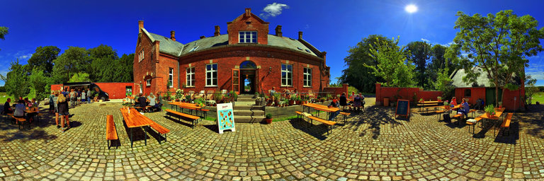
Добавить любой RSS - источник (включая журнал LiveJournal) в свою ленту друзей вы можете на странице синдикации.
Исходная информация - http://www.360cities.net/. Данный дневник сформирован из открытого RSS-источника по адресу http://www.360cities.net/rss/rss.xml, и дополняется в соответствии с дополнением данного источника. Он может не соответствовать содержимому оригинальной страницы. Трансляция создана автоматически по запросу читателей этой RSS ленты. По всем вопросам о работе данного сервиса обращаться со страницы контактной информации.[Обновить трансляцию]
360° panorama by Jose De Queiroz. Click the image to open the interactive version.
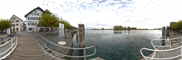
The small village holds great treasures Gottlieben lies on the Seerhein, the short waterway between Lake Constance and Untersee. Gottlieben has around 300 inhabitants and is one of the smallest communities in Switzerland in terms of area. The picturesque townscape is characterised by beautiful half-timbered houses from the 17th century, idyllic corners and a beautiful plane tree avenue. The small village holds great treasures. Gottlieben Castle was once owned by the French Emperor Napoleon III. It is best seen from the water. The most impressive half-timbered building houses the hotel restaurant "Drachenburg". Furthermore, the famous Gottlieber H"uppen, the two large shipyards, the literature house "Bodman" and the craft trade are to be mentioned. Gottlieben is the pearl of the Seerhein
360° panorama by Jose De Queiroz. Click the image to open the interactive version.
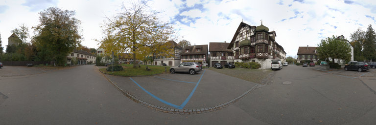
The enchanting and sleepy town of Gottlieben on Lake Constance in Thurgau (Switzerland), just under three kilometers from Konstanz and Kreuzlingen, is located away from the noisy thoroughfares on the Swiss side of the Seerhein.
360° panorama by Jose De Queiroz. Click the image to open the interactive version.
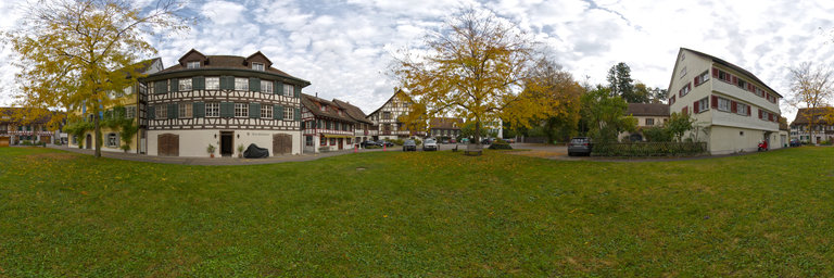
Gottlieben is a municipality in the district of Kreuzlingen at the mouth of the Rhine in the canton of Thurgau in Switzerland.
360° panorama by Jose De Queiroz. Click the image to open the interactive version.
Gottlieben is a municipality in the district of Kreuzlingen at the mouth of the Rhine in the canton of Thurgau in Switzerland.
360° panorama by Santiago Ribas - 360portugal. Click the image to open the interactive version.
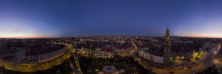
The history of the Cl'erigos architectural ensemble is related to the Brotherhood of Cl'erigos, an association of the faithful that was founded in the early 18th century with the aim of providing assistance to the clergy. At a time when in Portugal the clergy was very numerous, many of its members faced great difficulties throughout their lives, so the concentration of all assistance in a single institution represented a remarkable volume of services and a dynamic that quickly made the insufficiency clear of the initial facilities, located in a borrowed house: the Igreja da Miseric'ordia. The urgent need for a space of its own made it possible to overcome the stigmas resulting from the peculiar neighborhood and, in 1731, when Dean Jer'onimo de T'avora and Noronha was president, a project for the new church was requested to Nicolau Nasoni, Italian artist from Siena, who worked at the S'e works and at Quinta dos C'onegos in Maia. The work will start with the Church 1732-1749, with great difficulties due to the slope of the land, and problems with the weight of the facade on the foundations. The Casa da Irmandade and the Torre were built between 1750-1763, on an acquired land called "Adro dos Justicados ou Enforcados". With an elliptical centered plant, covered by a dome, it is an example of the granite baroque, already with Rococo influences. The Altar-mor 1767-1780 is made of marble stone of various colors, with the risk of Manuel dos Santos Porto. The Tower of Cl'erigos rises 75 meters high, it was the tallest building in the city. It has a carillon of 49 bells acquired in 1995. In addition to serving as a bell tower, this building had other uses over the years: it served to mark the time (through a daily shot of dry powder that marked noon); he was a commercial telegraph; it was used as a guideline for vessels sailing on the Douro River; it served to raise a flag when the "packet" arrived so that the traders would know of its approach; it was a strategic point for military and political combat; and today it is undoubtedly one of the most important tourist attractions in the city of Porto
360° panorama by Santiago Ribas - 360portugal. Click the image to open the interactive version.
The history of the Cl'erigos architectural ensemble is related to the Brotherhood of Cl'erigos, an association of the faithful that was founded in the early 18th century with the aim of providing assistance to the clergy. At a time when in Portugal the clergy was very numerous, many of its members faced great difficulties throughout their lives, so the concentration of all assistance in a single institution represented a remarkable volume of services and a dynamic that quickly made the insufficiency clear of the initial facilities, located in a borrowed house: the Igreja da Miseric'ordia. The urgent need for a space of its own made it possible to overcome the stigmas resulting from the peculiar neighborhood and, in 1731, when Dean Jer'onimo de T'avora and Noronha was president, a project for the new church was requested to Nicolau Nasoni, Italian artist from Siena, who worked at the S'e works and at Quinta dos C'onegos in Maia. The work will start with the Church 1732-1749, with great difficulties due to the slope of the land, and problems with the weight of the facade on the foundations. The Casa da Irmandade and the Torre were built between 1750-1763, on an acquired land called "Adro dos Justicados ou Enforcados". With an elliptical centered plant, covered by a dome, it is an example of the granite baroque, already with Rococo influences. The Altar-mor 1767-1780 is made of marble stone of various colors, with the risk of Manuel dos Santos Porto. The Tower of Cl'erigos rises 75 meters high, it was the tallest building in the city. It has a carillon of 49 bells acquired in 1995. In addition to serving as a bell tower, this building had other uses over the years: it served to mark the time (through a daily shot of dry powder that marked noon); he was a commercial telegraph; it was used as a guideline for vessels sailing on the Douro River; it served to raise a flag when the "packet" arrived so that the traders would know of its approach; it was a strategic point for military and political combat; and today it is undoubtedly one of the most important tourist attractions in the city of Porto
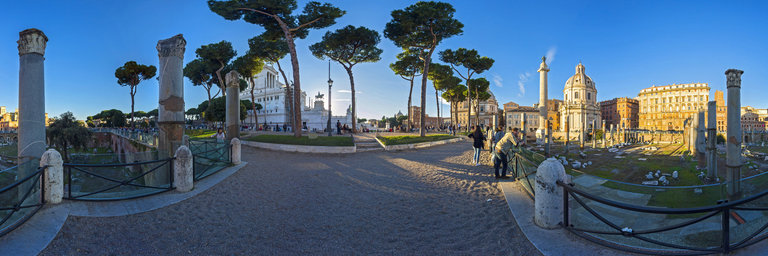
360° panorama by Eugene Orlov. Click the image to open the interactive version.
Basilica Ulpia was built at the beginning of the second century. The name of the basilica was in honor of the Roman Emperor Trajan.