Добавить любой RSS - источник (включая журнал LiveJournal) в свою ленту друзей вы можете на странице синдикации.
Исходная информация - http://www.360cities.net/. Данный дневник сформирован из открытого RSS-источника по адресу http://www.360cities.net/rss/rss.xml, и дополняется в соответствии с дополнением данного источника. Он может не соответствовать содержимому оригинальной страницы. Трансляция создана автоматически по запросу читателей этой RSS ленты. По всем вопросам о работе данного сервиса обращаться со страницы контактной информации.[Обновить трансляцию]
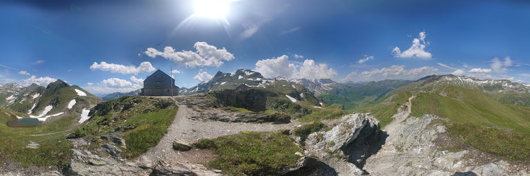
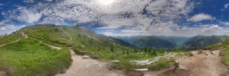
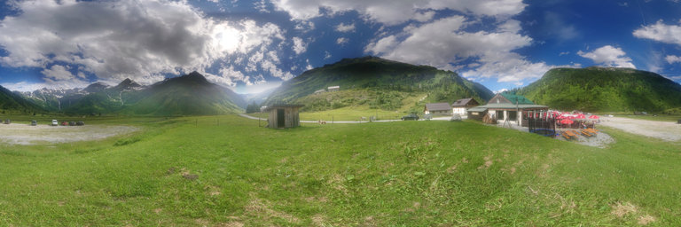
360° panorama by Jiri Syrovatko. Click the image to open the interactive version.
Bad Gastein, Austria, nice summer day 2020, after lifting off the Covid-19 restrictions. Hagener Hutte 2450m from south at Niederer Tauern pass, between Sportgastein valley and Mallnitz, above Sportgastein valley at 1600m. Made with Sony Xperia XZ1 Compact.
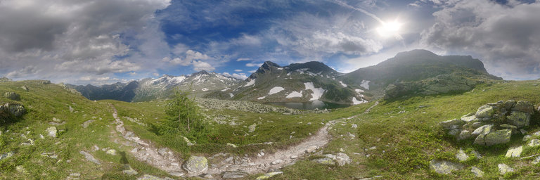
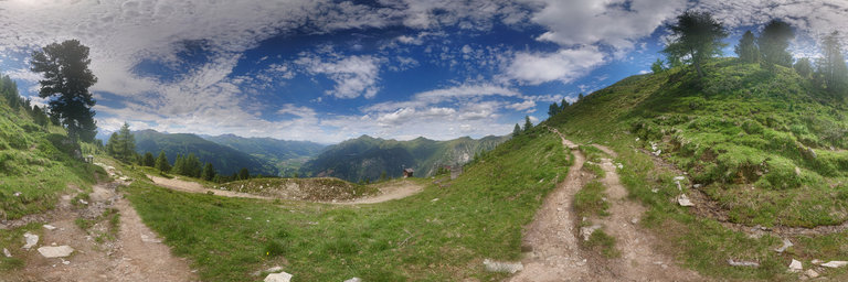
360° panorama by Jiri Syrovatko. Click the image to open the interactive version.
Bad Gastein, Austria, nice summer day 2020, after lifting off the Covid-19 restrictions. Windschursee 2240m, on trail from Palfner Scharte pass 2321m to Kotschachtal valley 1130m. Made with Sony Xperia XZ1 Compact.
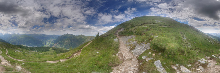
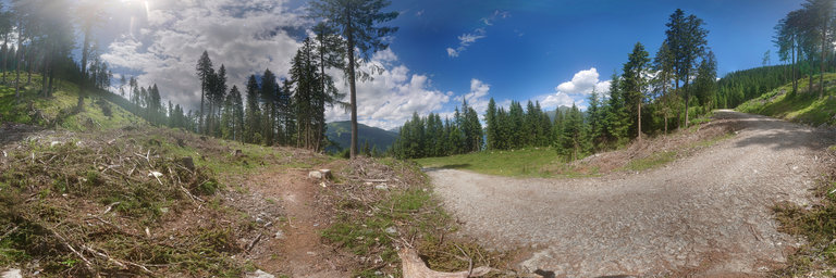
360° panorama by Jiri Syrovatko. Click the image to open the interactive version.
Bad Gastein, Austria, nice summer day 2020, after lifting off the Covid-19 restrictions. Path to Huttenkogel on the last high part, on trail from Bad Gastein 1050m to Huttenkogel 2231m. Made with Sony Xperia XZ1 Compact.
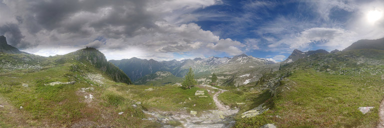
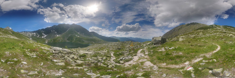
360° panorama by Jiri Syrovatko. Click the image to open the interactive version.
Bad Gastein, Austria, nice summer day 2020, after lifting off the Covid-19 restrictions. Windschurriegel 2175m, on trail from Palfner Scharte pass 2321m to Kotschachtal valley 1130m. Made with Sony Xperia XZ1 Compact.
360° panorama by Jiri Syrovatko. Click the image to open the interactive version.
Bad Gastein, Austria, nice summer day 2020, after lifting off the Covid-19 restrictions. Path to Huttenkogel on the last high part, on trail from Bad Gastein 1050m to Huttenkogel 2231m. Made with Sony Xperia XZ1 Compact.
360° panorama by Jiri Syrovatko. Click the image to open the interactive version.
Bad Gastein, Austria, nice summer day 2020, after lifting off the Covid-19 restrictions. Trail above Graukogel Alm 1550m on trail from Bad Gastein 1050m to Huttenkogel 2231m. Made with Sony Xperia XZ1 Compact.
360° panorama by Jiri Syrovatko. Click the image to open the interactive version.
Bad Gastein, Austria, nice summer day 2020, after lifting off the Covid-19 restrictions. Above Palfnersee 2100m on trail from Huttenkogel to Kotschachbach valley. Made with Sony Xperia XZ1 Compact.
360° panorama by Jiri Syrovatko. Click the image to open the interactive version.
Bad Gastein, Austria, nice summer day 2020, after lifting off the Covid-19 restrictions. On a beginning of mountain trail from Sportgastein to Niedersachsenhaus and Bockhartsee, at a restaurant Valeriehaus. Made with Sony Xperia XZ1 Compact.
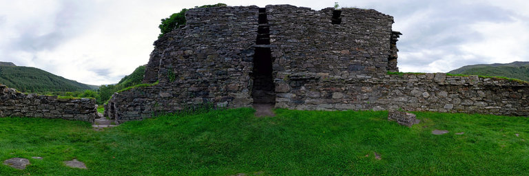
360° panorama by Gary Davies. Click the image to open the interactive version.
Dun Telve is one of two brochs located close to each other in the valley of Gleann Beag, near the village of Glenelg. Each was built around 2,000 and 2,500 years ago. A Broch is an Iron Age structure designed to both impress and defend. Their general layout comprised two concentric stone walls with a stairway or access within the walls to the upper floors. This would have been easily defensible for an extended family and their livestock.
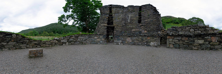
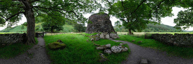
360° panorama by Gary Davies. Click the image to open the interactive version.
Dun Troddan is one of two brochs located close to each other in the valley of Gleann Beag, near the village of Glenelg. Each was built around 2,000 and 2,500 years ago. A Broch is an Iron Age structure designed to both impress and defend. Their general layout comprised two concentric stone walls with a stairway or access within the walls to the upper floors. This would have been easily defensible for an extended family and their livestock.
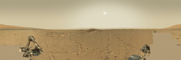
360° panorama by Andrew Bodrov. Click the image to open the interactive version.
NASA's Mars Exploration Program (Image credit: NASA/JPL-Caltech/MSSS) Sol 592: Data Campaign The images for panorama obtained by the rover's 34-millimeter Mast Camera. The mosaic, which stretches about 30,000 pixels width, includes 138 images taken on Sol 592 (April 5, 2014). Planning for the weekend focused on investigating the troughs in front of the rover with ChemCam, Mastcam and MAHLI, then driving about 12 meters along the edge of the Kimberley outcrop and taking mid-drive measurements of subsurface hydrogen (water ice) content with DAN and imaging the outcrop with Mastcam. Lots of data are being acquired, so extra attention is being paid to prioritizing various observations so that they are received in the order they are needed. It may be a while before all of the data acquired during this waypoint campaign are received on Earth. Written by Ken HerkenhoffUSGS Scientist Other panoramas of Mars by Curiosity rover: http://www.360cities.net/sets/curiosity-mars
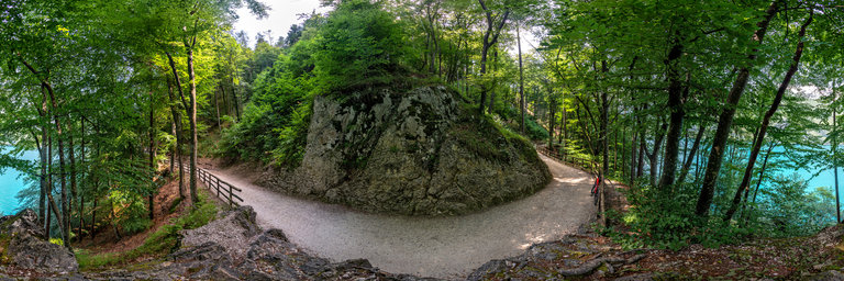
360° panorama by dbortola. Click the image to open the interactive version.
A splendid cycle path, accessible and suitable for everyone, surrounds Lake Ledro, a magnificent body of water in Trentino Alto Adige. The position of this shot is in a stretch of the southern slope, the one covered by a shady pine forest, perfect in summer.