Добавить любой RSS - источник (включая журнал LiveJournal) в свою ленту друзей вы можете на странице синдикации.
Исходная информация - http://www.360cities.net/. Данный дневник сформирован из открытого RSS-источника по адресу http://www.360cities.net/rss/rss.xml, и дополняется в соответствии с дополнением данного источника. Он может не соответствовать содержимому оригинальной страницы. Трансляция создана автоматически по запросу читателей этой RSS ленты. По всем вопросам о работе данного сервиса обращаться со страницы контактной информации.[Обновить трансляцию]
360° panorama by Jiri Syrovatko. Click the image to open the interactive version.
On a mountain trail above Sportgastein valley near Bockhartsee. Made with Sony Xperia XZ1 Compact.
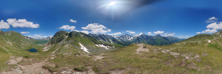
360° panorama by Jiri Syrovatko. Click the image to open the interactive version.
On a mountain Bockhart 2260m, above Bockhartsee, trail from Sportgastein (Nassfeld). Made with Sony Xperia XZ1 Compact.
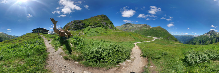
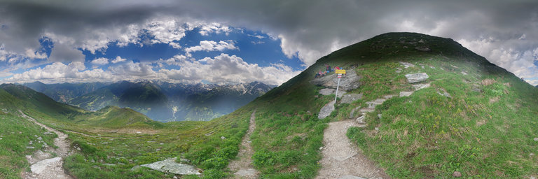
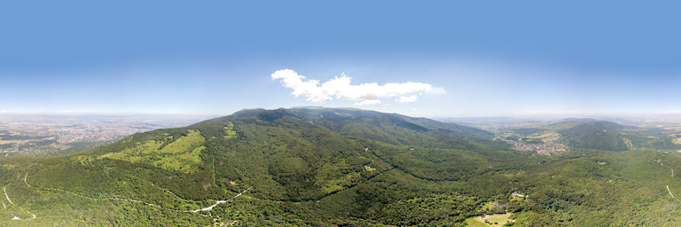
360° panorama by Jiri Syrovatko. Click the image to open the interactive version.
On a mountain trail from Stubnekogel, below Tischkogel. Made with Sony Xperia XZ1 Compact.
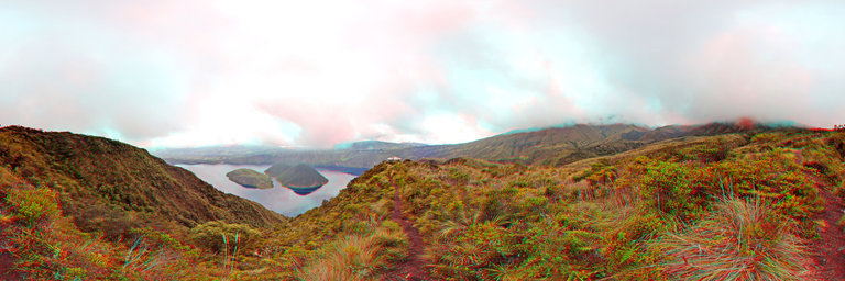
360° panorama by Juan Jose Perez. Click the image to open the interactive version.
From Wikipedia, the free encyclopedia Cuicocha (kucha = lake) is a 3 km (2 mi) wide caldera and crater lake at the foot of Cotacachi Volcano in the Cordillera Occidental of the Ecuadorian Andes. Its name comes from the Kichwa Indigenous language and signifies: "Lago del Cuye" or Guinea Pig Laguna in English. It was given this name due to the shape of the largest Island located in the middle of the Laguna is full of Guinea Pigs. These animals play a significant part in the everyday life of Ecuadorians, as it reproduces rapidly and needs a minimum of food and care to survive, it makes for an excellent high protein meal especially for populations living in altitude. The caldera was created by a massive phreatic eruption about 3100 years ago that generated about 5 cubic kilometres (6.54 billion cubic yards) of pyroclastic flow and covered the surrounding area in volcanic ash up to 20 cm (8 inches) deep. The volcano has been dormant since that time. In combination with other eruptions from nearby Imbabura, Mojanda, Cotacachi, and Cayambe, Cuicocha is responsible for the fertile soil of the Otavalo valley.[1] Cuicocha Lake Coordinates 0°18.001'N 78°21.001'W Lake type crater lake Basin countries Ecuador Max. length 3 km Islands 2 (Teodoro Wolf, Yerovi) The crater lake within the Cuicocha caldera contains four dacitic lava domes which form two steep forested islands: Yerovi, the smaller, and Teodoro Wolf, the larger. People are prohibited on both.[2] The rim of the caldera is extremely steep – so steep, in fact, that the accumulation of sediment is insufficient for most hydrophyte vegetation. An older lava dome from the Pleistocene forms part of the eastern rim. The lake, which is 200 m (656 ft) deep at its deepest point, is highly alkaline and contains little life.[3] It has no known outlet. The intra-caldera islands, on the other hand, support some wildlife, most notably the Silvery Grebe, which lives around the reeds and feeds on small fish, frogs, crayfish, small water snakes, seeds of water plants, and insects. The bird is found in upper temperate and lower p'aramo zones throughout the Andes, but little is known about the species. In 1974 a census was taken of the population of grebes at Cuicocha and 44 birds were found.[4] Cuicocha forms the southern end of the Cotacachi-Cayapas Ecological Reserve. During the second day of Inti Raymi (or Sun Festival) every summer solstice, indigenous shaman use Cuicocha as a bath of ritual cleansing and purification.[5] From Wikipedia, the free encyclopedia