Добавить любой RSS - источник (включая журнал LiveJournal) в свою ленту друзей вы можете на странице синдикации.
Исходная информация - http://www.360cities.net/. Данный дневник сформирован из открытого RSS-источника по адресу http://www.360cities.net/rss/rss.xml, и дополняется в соответствии с дополнением данного источника. Он может не соответствовать содержимому оригинальной страницы. Трансляция создана автоматически по запросу читателей этой RSS ленты. По всем вопросам о работе данного сервиса обращаться со страницы контактной информации.[Обновить трансляцию]
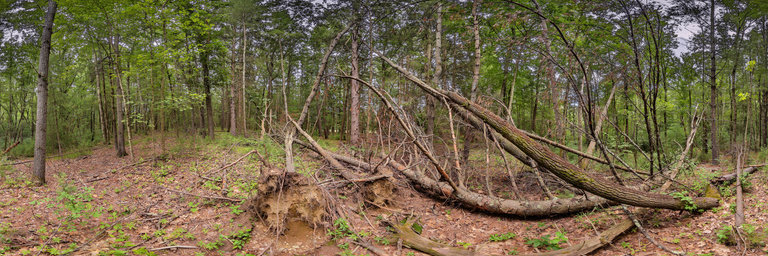
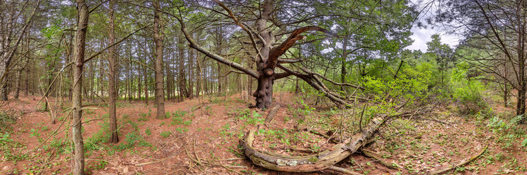
360° panorama by John Wood. Click the image to open the interactive version.
Most likely these trees were uprooted and trunks broken off by a microburst. These occur as cold dense air from a decaying thunderstorm descends to the ground and flattens out into high velocity wind. Most of the trees are knocked over pointing to the southeast. Note that a level F1 tornado touched down in nearby Gowling's swamp in August 2016.
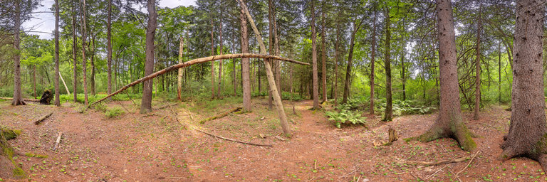
360° panorama by John Wood. Click the image to open the interactive version.
A widowmaker, also known by lumberjacks as a fool killer, is part of a tree that has broken off but not hit the ground. This one is delicately suspended over the trail, awaiting an unwary hiker. The photographer was unable to dislodge it without tools.
360° panorama by John Wood. Click the image to open the interactive version.
The Concord Land Conservation Trust (CLCT) is a private, non-profit, 501(c)(3) tax-exempt organization devoted to the preservation of open land in the Town of Concord. Founded in 1959, CLCT has seven trustees and over 650 member families. CLCT seeks to conserve the natural resources of Concord and the town’s traditional landscape of woods, meadows, and fields.
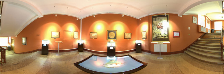
360° panorama by Konstantin Kharin. Click the image to open the interactive version.
The photo has been taken in July, 2020, at 3Da Vinci museum of Russian State University for the Humanities at day time. On a picture you can see exhibits of the fifth floor of the museum
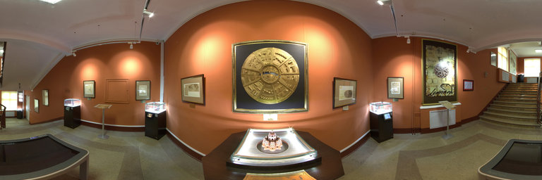
360° panorama by Konstantin Kharin. Click the image to open the interactive version.
The photo has been taken in July, 2020, at 3Da Vinci museum of Russian State University for the Humanities at day time. On a picture you can see exhibits of the eighth floor of the museum
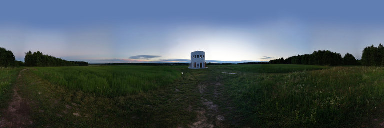
360° panorama by Torsten Brumm. Click the image to open the interactive version.
On the 30th anniversary of the establishment of most national parks, biosphere reserves and nature parks in eastern Germany, Mecklenburg-Western Pomerania will host the Glasarche in 2020. Located directly on the Elberadweg and on the B 5 (Boizenburg-Vier exit) and in the immediate vicinity of the famous Elwkieker lookout tower and the EinFlussReich open-air exhibition in Boizenburg / Elbe - we would like to prepare you for your visit to the UNESCO Biosphere Reserve. More Information at: https://www.glasarche-3.de/standorte/boizenburg/
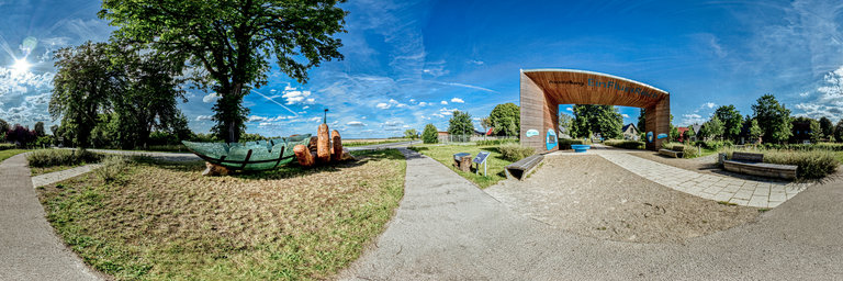
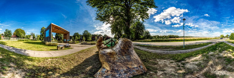
360° panorama by Gary Davies. Click the image to open the interactive version.
Located on the Ardmeanach Peninsula on the Isle of Mull, the Burg is a dramatic Hebridean wilderness exposed to the full force of the Atlantic Ocean. The area is famous for its rocky coastline that contains numerous imprints of fossilised trees, formed around 50 million years ago.
360° panorama by Gary Davies. Click the image to open the interactive version.
Little is known about the roofless Pennygown Chapel. It is thought to date from the late 12th or early 13th century although it has not been recorded in any medieval references. http://www.mull-historical-society.co.uk/churches/churches-2/pennygown/
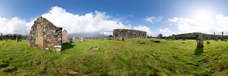
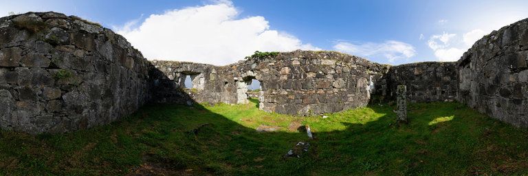
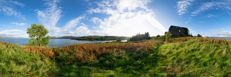
360° panorama by Gary Davies. Click the image to open the interactive version.
Aros Castle consists of a ruined 13th century hall house with an overgrown courtyard littered by fallen masonry. Standing on a high rock promontory with a steep drop to the beach, and a ditch and wall on the landward side with a drawbridge, it was once an important stronghold of the Lords of the Isles.
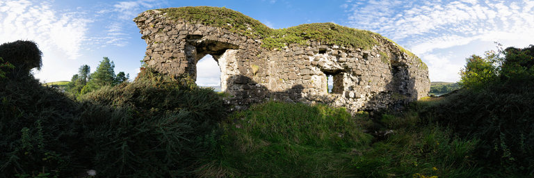
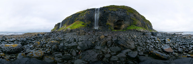
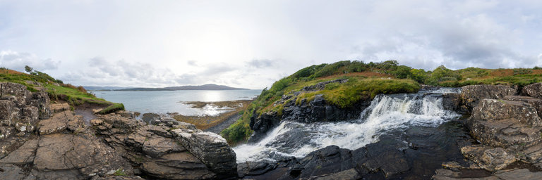
360° panorama by Gary Davies. Click the image to open the interactive version.
Located on the west coast of Mull, close to the Ulva ferry, Eas Fors consists of a series of three waterfalls, with the final fall plunging over a sheer cliff edge into to the sea below. The name literally means Waterfall Waterfall Waterterfall as Eas is Gaelic for waterfall and Fors translates as waterfall in Norse.