Добавить любой RSS - источник (включая журнал LiveJournal) в свою ленту друзей вы можете на странице синдикации.
Исходная информация - http://www.360cities.net/. Данный дневник сформирован из открытого RSS-источника по адресу http://www.360cities.net/rss/rss.xml, и дополняется в соответствии с дополнением данного источника. Он может не соответствовать содержимому оригинальной страницы. Трансляция создана автоматически по запросу читателей этой RSS ленты. По всем вопросам о работе данного сервиса обращаться со страницы контактной информации.[Обновить трансляцию]
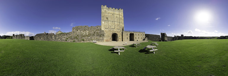
360° panorama by Gary Davies. Click the image to open the interactive version.
Richmond Castle was built on land gifted to Alan Rufus, a kinsman of William the Conqueror, soon after the Norman Conquest of 1066. The square Great Tower, built over the original gatehouse in the 12th century, is of a typical Norman design with square turrets, a flat roof and shallow buttressing. The castle was declared a ruin in 1538 which probably saved it from being slighted after the English Civil War. In the Victorian era, the castle became the headquarters of the North York Militia. During WW1 it was occupied by the Northern Non-Combatant Corps, a unit of men seeking exemption from military service.
360° panorama by Gary Davies. Click the image to open the interactive version.
Founded in 1152 by Roald, Constable of the nearby Richmond Castle, Easby Abbey is one of the best preserved of three Premonstratensian monasteries founded in England. Unlike its sister-abbey at Egglestone, Easby was substantially enlarged through wealthy patronage. After its suppression in 1536 the buildings fell into ruin, before becoming an object of interest for antiquarians and Romantic artists in the 18th and 19th centuries, including JMW Turner. The parish church within the precinct, which is still in use, contains rare 13th century wall paintings.
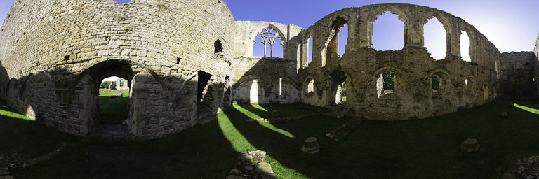
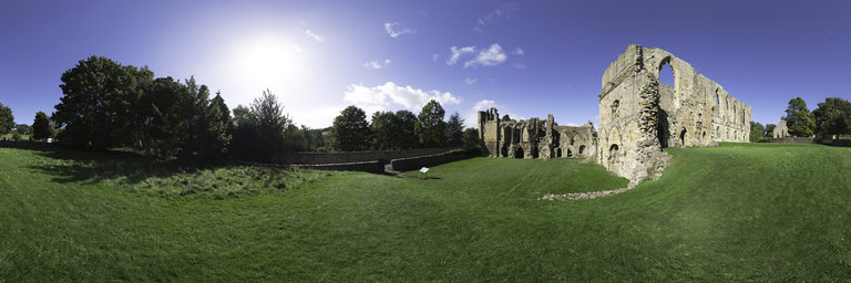
360° panorama by Andrew Bodrov. Click the image to open the interactive version.
The Mid-Atlantic Ridge (MAR) is a mid-ocean ridge, a divergent tectonic plate or constructive plate boundary located along the floor of the Atlantic Ocean, and part of the longest mountain range in the world. In the North Atlantic it separates the Eurasian and North American Plates, and in the South Atlantic it separates the African and South American Plates. The ridge extends from a junction with the Gakkel Ridge (Mid-Arctic Ridge) northeast of Greenland southward to the Bouvet Triple Junction in the South Atlantic. Although the Mid-Atlantic Ridge is mostly an underwater feature, portions of it have enough elevation to extend above sea level. The section of the ridge that includes the island of Iceland is also known as the Reykjanes Ridge. The ridge has an average spreading rate of about 2.5 centimetres (0.98 in) per year. Source: Wikipedia
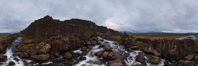
360° panorama by Andrew Bodrov. Click the image to open the interactive version.
Thingvellir, anglicised as Thingvellir, is a national park in the municipality of Bl'ask'ogabyggd in southwestern Iceland, about 40 km northeast of Iceland's capital, Reykjav'ik. Thingvellir is a site of historical, cultural, and geological significance, and is one of the most popular tourist destinations in Iceland. The park lies in a rift valley that marks the crest of the Mid-Atlantic Ridge and the boundary between the North American and Eurasian tectonic plates. To its south lies Thingvallavatn, the largest natural lake in Iceland. Thingvellir is associated with the Althing, the national parliament of Iceland, which was established at the site in 930 AD. Sessions were held at the location until 1798. Thingvellir National Park (thj'odgardurinn 'a Thingv"ollum) was founded in 1930, marking the 1000th anniversary of the Althing. The park was later expanded to protect the diverse and natural phenomena in the surrounding area, and was designated as a World Heritage Site in 2004. Source: Wikipedia
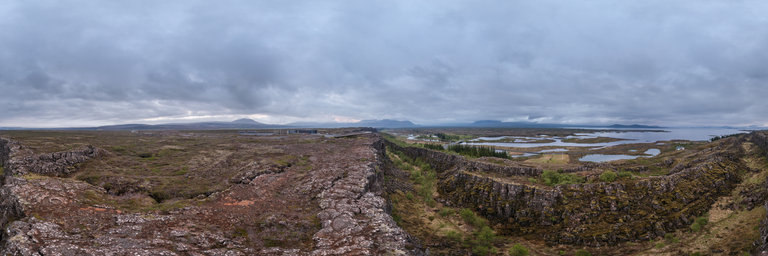