Добавить любой RSS - источник (включая журнал LiveJournal) в свою ленту друзей вы можете на странице синдикации.
Исходная информация - http://www.360cities.net/. Данный дневник сформирован из открытого RSS-источника по адресу http://www.360cities.net/rss/rss.xml, и дополняется в соответствии с дополнением данного источника. Он может не соответствовать содержимому оригинальной страницы. Трансляция создана автоматически по запросу читателей этой RSS ленты. По всем вопросам о работе данного сервиса обращаться со страницы контактной информации.[Обновить трансляцию]
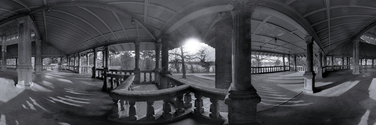
360° panorama by Martin Broomfield. Click the image to open the interactive version.
The Pavillion at Rockcliffe Park. The park was established in 1864 and was founded by Thomas Keefer. It is situated close to the Rideau Hall. The Pavillion overlooks the Ottawa River.
360° panorama by Martin Broomfield. Click the image to open the interactive version.
The Pavillion at Rockcliffe Park. The park was established in 1864 and was founded by Thomas Keefer. It is situated close to the Rideau Hall. The Pavillion overlooks the Ottawa River.
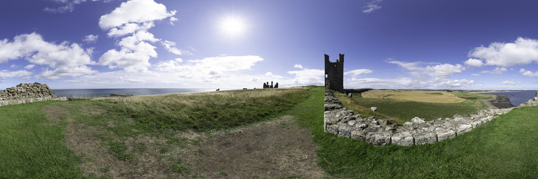
360° panorama by Gary Davies. Click the image to open the interactive version.
The ruins of Dunstanburgh Castle stand on a remote coastal headland in Northumberland, close to the Scottish border. Its name literally translates as ‘the fort’ (burgh) ‘of the town’ (dun) ‘by the rock’ (stan). It dates from 1319 with Thomas, Earl of Lancaster intending it to be more of a symbol of his opposition to the crown of Edward II than as a military stronghold. Unfortunately for the Earl he was captured and executed by the king who gifted the castle to John of Gaunt, one of this sons. He was responsible for converting the great twin towered gatehouse into a keep. The castle was twice besieged and captured by Yorkist forces during the 15th century Wars of the Roses after which it fell into decline and ruin. The Lilburn Tower was named after one of the constables of the castle. It stands on a cliff top at the highest point of the complex giving it clear views of the coastline.
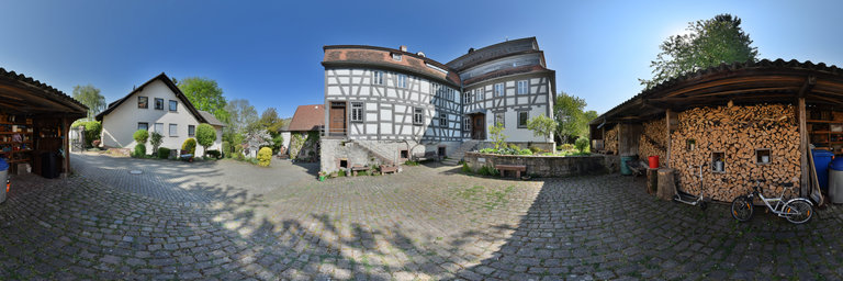
360° panorama by Ackermann Ralf. Click the image to open the interactive version.
Homburg am Main is a part of the market Triefenstein in the Lower Franconian district of Main-Spessart. The Homburg paper mill, built in 1807, and the attached museum are located here. The entire paper-making process is shown using historical machines. The authentically preserved production rooms provide clear information about manufacturing processes, working life and the situation in the paper mill.
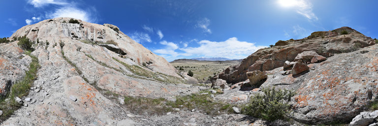
360° panorama by John Roberts. Click the image to open the interactive version.
The distant snowcapped Deseret Peak rises from the Stansbury mountains over the Skull valley as seen from the southern outcrop at White Rocks. The rock outcrop is some 40 million years old.
360° panorama by John Roberts. Click the image to open the interactive version.
The distant snowcapped Deseret Peak rises from the Stansbury mountains over the Skull valley as seen from the southern outcrop at White Rocks. The rock outcrop is some 40 million years old.
360° panorama by John Roberts. Click the image to open the interactive version.
The distant snowcapped Deseret Peak rises from the Stansbury mountains over the Skull valley as seen from the southern outcrop at White Rocks. The rock outcrop is some 40 million years old.