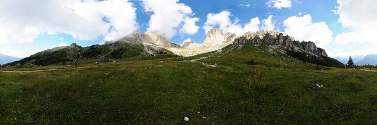
Добавить любой RSS - источник (включая журнал LiveJournal) в свою ленту друзей вы можете на странице синдикации.
Исходная информация - http://www.360cities.net/. Данный дневник сформирован из открытого RSS-источника по адресу http://www.360cities.net/rss/rss.xml, и дополняется в соответствии с дополнением данного источника. Он может не соответствовать содержимому оригинальной страницы. Трансляция создана автоматически по запросу читателей этой RSS ленты. По всем вопросам о работе данного сервиса обращаться со страницы контактной информации.[Обновить трансляцию]
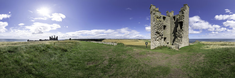
360° panorama by Gary Davies. Click the image to open the interactive version.
The ruins of Dunstanburgh Castle stand on a remote coastal headland in Northumberland, close to the Scottish border. Its name literally translates as ‘the fort’ (burgh) ‘of the town’ (dun) ‘by the rock’ (stan). It dates from 1319 with Thomas, Earl of Lancaster intending it to be more of a symbol of his opposition to the crown of Edward II than as a military stronghold. Unfortunately for the Earl he was captured and executed by the king who gifted the castle to John of Gaunt, one of this sons. He was responsible for converting the great twin towered gatehouse into a keep. The castle was twice besieged and captured by Yorkist forces during the 15th century Wars of the Roses after which it fell into decline and ruin. The Lilburn Tower was named after one of the constables of the castle. It stands on a cliff top at the highest point of the complex giving it clear views of the coastline.
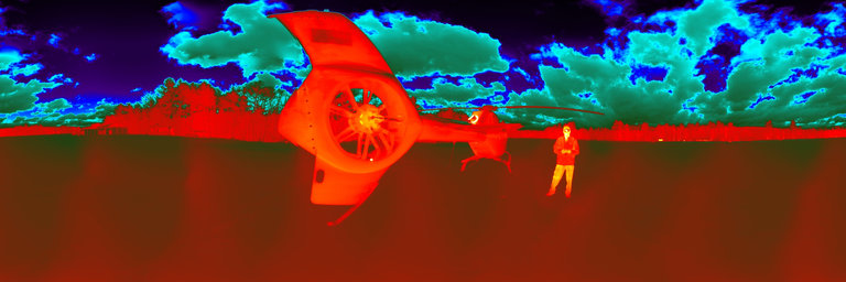
360° panorama by John Wood. Click the image to open the interactive version.
Infrared image made in the 7.5 to 13.5 micron wavelength range with FLIR Systems Vue Pro Radiometric Drone Thermal camera, showing heat radiated by people and objects. Source images normalized by Dr. Austin Richards. 1234 palette.
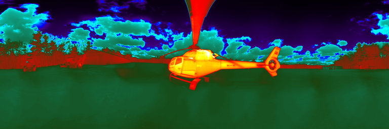
360° panorama by John Wood. Click the image to open the interactive version.
Infrared image made in the 7.5 to 13.5 micron wavelength range with FLIR Systems Vue Pro Radiometric Drone Thermal camera, showing heat radiated by people and objects. Source images normalized by Dr. Austin Richards. Colorwheel12 palette.
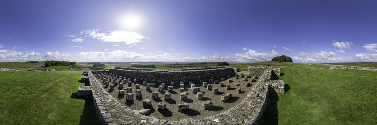
360° panorama by Gary Davies. Click the image to open the interactive version.
Housesteads, known as Vercovicium to the 1,000 soldiers garrisoned there, is the best preserved Roman fort in Britain. Standing on a hilltop alongside Hadrian's Wall, it was built in the 2nd century AD and used by the Romans for 300 years. During the late 17th century it was utilised as a stockade for stolen livestock by a family of notorious Border Reivers. The building illustrated is the remains of a granary. The stone pillars supported a raised floor to keep grain dry and free from vermin.
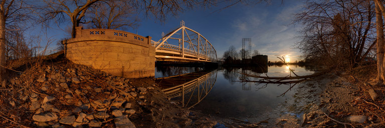
360° panorama by Martin Broomfield. Click the image to open the interactive version.
The Minto Bridges, constructed in 1900, crossing the Rideau river at New Edinburgh, Ottawa. The Old City Hall, on Green Island, can seen in the background. It now houses part Global Affairs Canada. Just beyond the bridge, the Rideau River cascades into the Ottawa River.
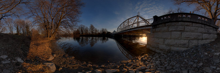
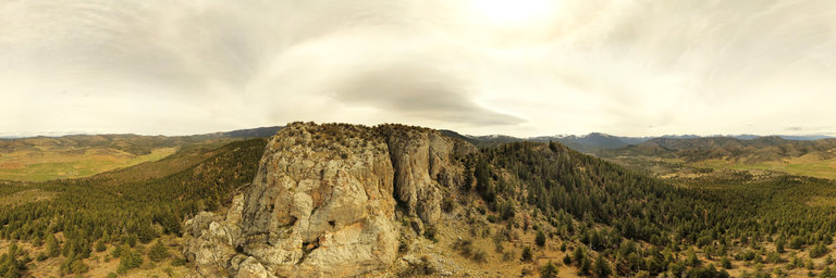
360° panorama by William l. Click the image to open the interactive version.
Aerial view about 150 feet up looking at the limestone cliff face of Lovers Leap near Callahan, California. The formation was formed during the Silurian epoch (about 430 million years ago) w/ fossil crinoids & corals found in particular deposits. Other limestone caps in the area date it among the oldest rocks in the region. Lovers Leap is a popular location for rock climbing w/ plenty of routes on all sides & on lower formations below.