Добавить любой RSS - источник (включая журнал LiveJournal) в свою ленту друзей вы можете на странице синдикации.
Исходная информация - http://www.360cities.net/. Данный дневник сформирован из открытого RSS-источника по адресу http://www.360cities.net/rss/rss.xml, и дополняется в соответствии с дополнением данного источника. Он может не соответствовать содержимому оригинальной страницы. Трансляция создана автоматически по запросу читателей этой RSS ленты. По всем вопросам о работе данного сервиса обращаться со страницы контактной информации.[Обновить трансляцию]
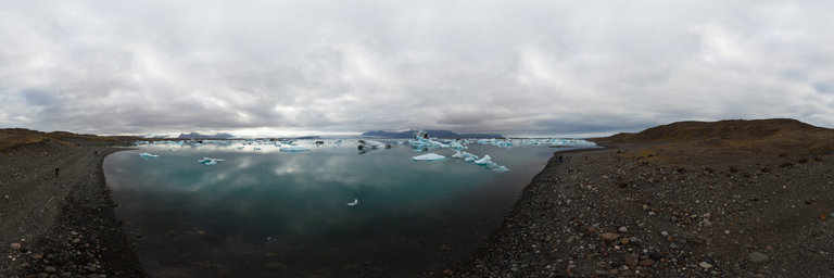
360° panorama by Andrew Bodrov. Click the image to open the interactive version.
J"okuls'arl'on (Ice Lagoon) is a large glacial lake in southeast Iceland, on the borders of Vatnaj"okull National Park. Situated at the head of Breidamerkurj"okull, it developed into a lake after the glacier started receding from the edge of the Atlantic Ocean. The lake has grown since then at varying rates because of melting of the Icelandic glaciers. The lake now stands 1.5 kilometres (0.93 mi) away from the ocean's edge and covers an area of about 18 km2 (6.9 sq mi). It recently became the deepest lake in Iceland at over 248 metres (814 ft) depth as glacial retreat extended its boundaries. It is considered as one of the natural wonders of Iceland. One can see the lake from along Route 1 between H"ofn and Skaftafell. The tongue of the Breidamerkurj"okull glacier is a major attraction for tourists. Tour operators conduct snowmobile and jeep tours to visit the glacier along the winding iceberg-studded J"okuls'arl'on. The base station for visits to the area is at Joklasel, which is approached from Hofn. Source: Wikipedia
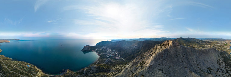
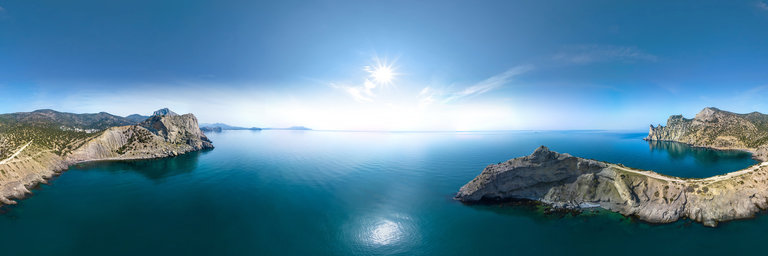
360° panorama by Alexei Merinov. Click the image to open the interactive version.
Aerial view near the top of Sokol Mountain between the small Black Sea village of Novyi Svet and the city of Sudak (Eastern Crimea) - an aerial view on a spring day in late April. Black Sea, mountains, with beautiful cliffs
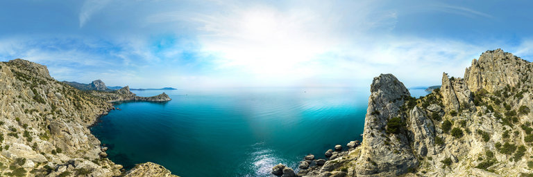
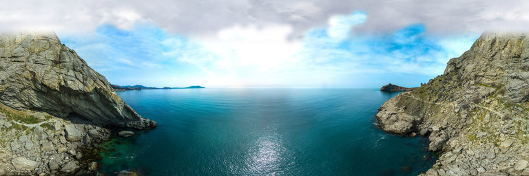
360° panorama by Alexei Merinov. Click the image to open the interactive version.
aerial view near the Turtle Head rock in the small Black Sea village Novyi Svit (East Crimea) - aerial view on a spring day in late April. Black Sea, mountains, with beautiful cliffs
360° panorama by Alexei Merinov. Click the image to open the interactive version.
aerial view near the Turtle Head rock in the small Black Sea village Novyi Svit (East Crimea) - aerial view on a spring day in late April. Black Sea, mountains, with beautiful cliffs
360° panorama by Alexei Merinov. Click the image to open the interactive version.
aerial view near Cape Kachik in a small Black Sea village Novyi Svit (East Crimea) - aerial view on a spring day in late April. Black Sea, mountains, with beautiful cliffs
360° panorama by Alexei Merinov. Click the image to open the interactive version.
aerial view near Cape Kachik in a small Black Sea village Novyi Svit (East Crimea) - aerial view on a spring day in late April. Black Sea, mountains, with beautiful cliffs
360° panorama by Alexei Merinov. Click the image to open the interactive version.
aerial view near the Golitsyn grotto in a small Black Sea village Novyi Svit (East Crimea) - aerial view on a spring day in late April. Black Sea, mountains, with beautiful cliffs
360° panorama by Alexei Merinov. Click the image to open the interactive version.
aerial view near the Golitsyn grotto in a small Black Sea village Novyi Svit (East Crimea) - aerial view on a spring day in late April. Black Sea, mountains, with beautiful cliffs