Добавить любой RSS - источник (включая журнал LiveJournal) в свою ленту друзей вы можете на странице синдикации.
Исходная информация - http://www.360cities.net/. Данный дневник сформирован из открытого RSS-источника по адресу http://www.360cities.net/rss/rss.xml, и дополняется в соответствии с дополнением данного источника. Он может не соответствовать содержимому оригинальной страницы. Трансляция создана автоматически по запросу читателей этой RSS ленты. По всем вопросам о работе данного сервиса обращаться со страницы контактной информации.[Обновить трансляцию]
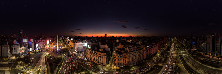
360° panorama by Jorge Vidal. Click the image to open the interactive version.
Protest at the Obelisk Buenos Aires at Night on October 12, 2020, 7 months of COVID-19 quarantine.
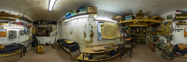
360° panorama by Jorge Vidal. Click the image to open the interactive version.
Factory of Alex Leibiusky constructor of nylon, steel, Weissenborn (Hawaiian) string guitars, ukuleles and chordophones of the world in Buenos Aires Argentina.
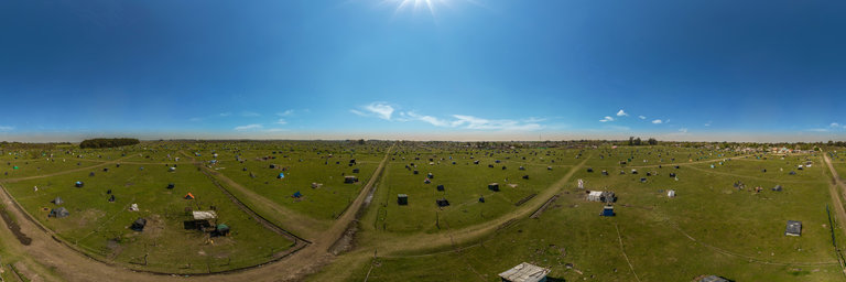
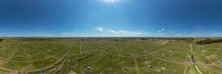
360° panorama by Jorge Vidal. Click the image to open the interactive version.
The lands of Guernica in Buenos Aires recognize a historical link with what were originally the ancient curatos of the San Vicente area. In 1618 the Franciscan fathers established a reduction of Querandi Indians. This image represents the usurpations during the Covid-19 quarantine in Argentina.
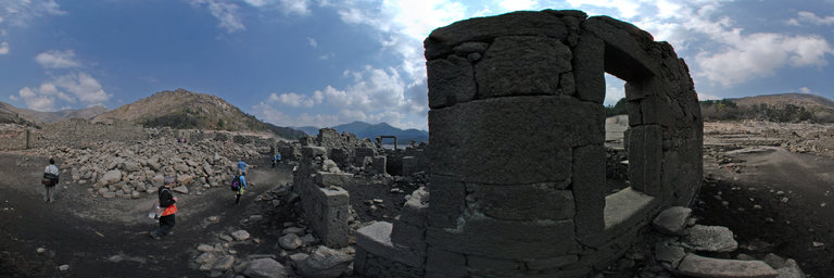
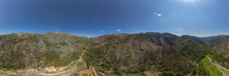
360° panorama by Santiago Ribas - 360portugal. Click the image to open the interactive version.
Shrine built during the 18th and 19th centuries on a former chapel dedicated to Na Sra das Neves. It was opened in 1857, when its staircase was still being finalized. It follows the scheme of the hill-sacral of Veresa, in Italy. The Way of the Cross begins at the Church's terreiro, with 7 hexagonal chapels on the right side, showing scenes from Jesus' childhood. At the end of the descent we arrive at the porch square, centered on a column topped by the Archangel S~ao Gabriel. Going back up we have on the right side, 13 smaller chapels, containing images related to the end of Christ's life. The legend of the miracle of Nossa Senhora das snows, dates back to August 5, 1220; when among the rocks a shepherdess pastured some goats, the Lady appeared to him, which they say in the form of a white dove flying around her, and sends - telling the inhabitants of his place in Gavieira to build a chapel there.
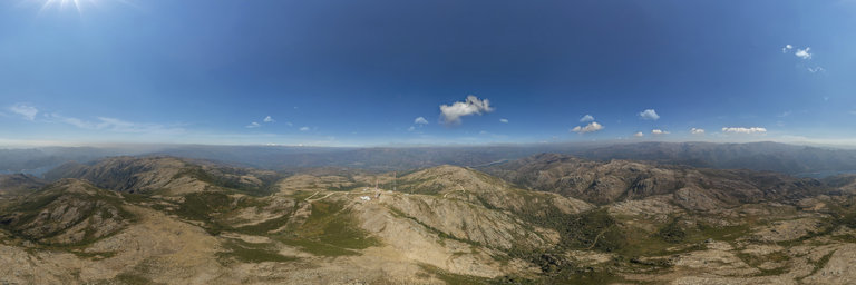
360° panorama by Santiago Ribas - 360portugal. Click the image to open the interactive version.
The Peneda-Ger^es National Park is considered by UNESCO as a World Biosphere Reserve. We are in the Serra da Amarela, at an altitude of 1366m, over its highest point, Lourica. From here we can see the reservoirs of Lindoso and Vilarinho das Furnas simultaneously
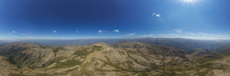
360° panorama by Santiago Ribas - 360portugal. Click the image to open the interactive version.
The Peneda-Ger^es National Park is considered by UNESCO as a World Biosphere Reserve. It is one of the biggest natural attractions of Portugal, for the rare and impressive landscape beauty and for the ecological and ethnographic value and for the variety of fauna (bucks, garranos, wolves, birds of prey) and flora (pine, yew, chestnut, oak and several plants medicinal). It extends from the Serra do Ger^es, to the South, passing through the Serra da Peneda to the Spanish border.
360° panorama by Santiago Ribas - 360portugal. Click the image to open the interactive version.
The village of Vilarinho da Furna, was under water with the construction of the dam in 1971. It was a community village, whose origins are lost in the mists of memory, and its antiquity is unknown. In the Inquiries of 1220, by D. Afonso II, and in 1258, D. Afonso III, there are references to the parish of S~ao Jo~ao do Campo, but nothing is found regarding Vilarinho da Furna. However, in the District Archive of Braga, there is the first reference to Vilarinho, in the Tombo of the S~ao Jo~ao do Campo Church, from 1540, as well as the Parish Archives, from 1623. It seems that it became an autonomous parish of the municipality of Terras de Bouro, having subsequently become a village in the parish of S~ao Jo~ao do Campo. And it is known that it was the last village through which the famous “Jeira” passed before entering Galicia, the old military route from Braga to Astorga. In human evolution, community organization corresponds to a cultural cycle resulting from the transition from nomadic herding to sedentary agriculture. In Vilarinho da Furna, until 1971, a very perfect community organization was preserved, which shows the superiority of an economy that combines the potential of the pastoral and agricultural economies, a system of community organization, once very widespread in Europe.
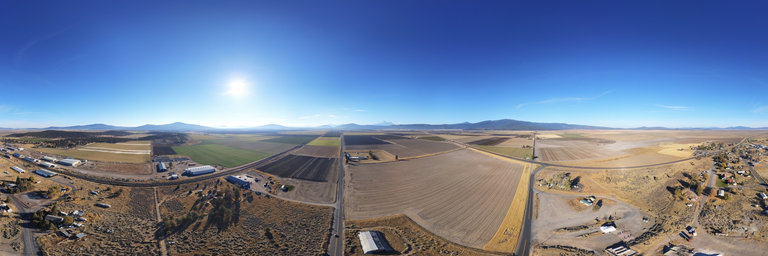
360° panorama by William l. Click the image to open the interactive version.
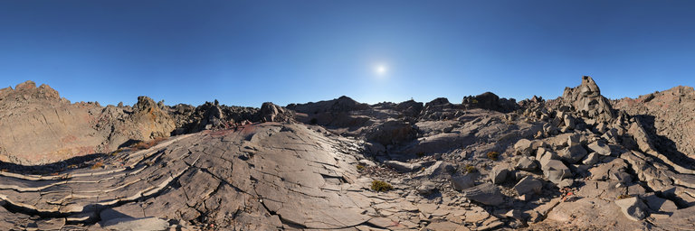
Looking at the inhospitable landscape of the Little Glass Mountain obsidian flow in the Medicine Lake area of California. It is smaller than nearby Glass Mountain, being about a square mile in size & just over 1,000 years of age. Here it is mostly dacite however the slopes of the flow contain an abundance of nice black obsidian.
360° panorama by William l. Click the image to open the interactive version.
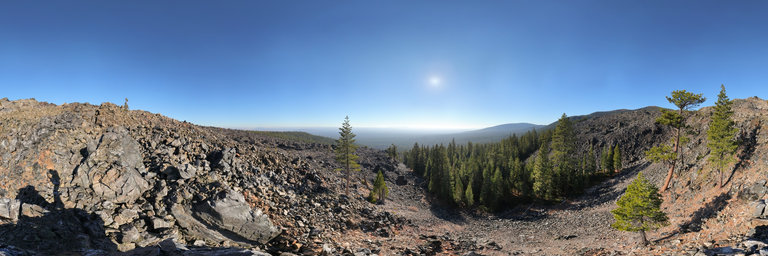
The Glass Mountain obsidian flow lies at the eastern end of the Medicine Lake Caldera in California. Glass Mountain consists of a large pile of obsidian that erupted around 900-1000 years ago from 13 different fissures. The obsidian varies from familiar black shiny outcroppings to obsidian froth. No rock collecting allowed.
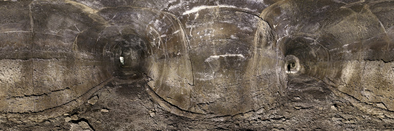
360° panorama by William l. Click the image to open the interactive version.
A view inside Harvestmen Cave, a single-passage lava tube that is roughly 2,600 feet in length. It is remarkably well-preserved with minimal breakdown & has easy walking with 7-30 foot high ceilings, though averaging about 10 feet. The width of the cave is narrower at about 10 feet on average. The cave has a couple of skylight openings, including one visible towards the lower end just around the corner from this long passageway. In the other direction, the cave takes a right turn & lowers its ceiling about 100 feet to an abrupt lava seal.
360° panorama by William l. Click the image to open the interactive version.
Rosebud Helipond is a waterhole in the Soda Mountain Wilderness (Cascade Siskiyou National Monument) south of Pinehurst, Oregon. It is spring-fed & an oasis for livestock with this trough still fully operational. It may have also been a water source for helicopters, at least based upon its name.
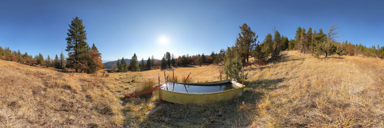
360° panorama by William l. Click the image to open the interactive version.
Rosebud Helipond is a waterhole in the Soda Mountain Wilderness (Cascade Siskiyou National Monument) south of Pinehurst, Oregon. It is spring-fed & an oasis for livestock. It may have also been a water source for helicopters, at least based upon its name.