Добавить любой RSS - источник (включая журнал LiveJournal) в свою ленту друзей вы можете на странице синдикации.
Исходная информация - http://www.360cities.net/. Данный дневник сформирован из открытого RSS-источника по адресу http://www.360cities.net/rss/rss.xml, и дополняется в соответствии с дополнением данного источника. Он может не соответствовать содержимому оригинальной страницы. Трансляция создана автоматически по запросу читателей этой RSS ленты. По всем вопросам о работе данного сервиса обращаться со страницы контактной информации.[Обновить трансляцию]
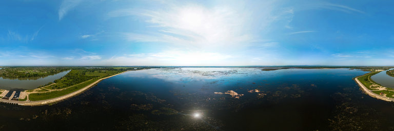
360° panorama by Alexei Merinov. Click the image to open the interactive version.
aerial panorama over the Shapshug reservoir and the Kuban river near the village of Khomuty (South of Russia, Adygea). The new sluice of the Shapshugsky reservoir on a sunny day
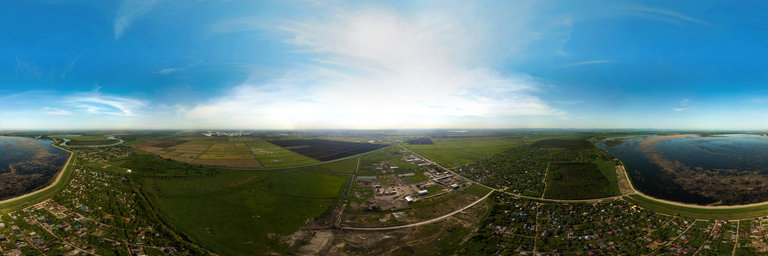
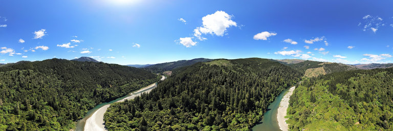
360° panorama by Alexei Merinov. Click the image to open the interactive version.
aerial panorama over the dacha village near the village of Khomuty (South of Russia, Adygea), Shapshugskoye and the Kuban river - the flow from the lock of the Shapshugskoye reservoir into the Kuban river on a sunny day
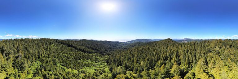
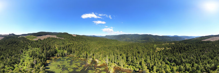
360° panorama by William l. Click the image to open the interactive version.
While redwoods are found mostly along the Northern California Coast, there are two groves of redwoods in the southwestern corner of Oregon. This one is located on Peavine Ridge & hosts a number of giant trees up to 250 feet in height. The largest ones here are up to ten feet in width though are much smaller than their neighbors to the south. A loop trail follows the ridge while a longer trail follows through a predominantly younger forest. This 300' aerial views shows the dense jungle of forest w/ views of the Pacific Ocean to the west. This old road now converted to a trailhead access ended at the visible seen square clearcut, now heavily overgrown. The forest from this vantage is mixed redwood - their trees easily spotted as their crown contains evenly spread uniform branches.
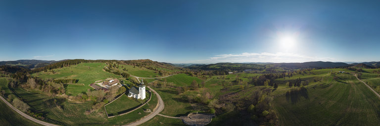
360° panorama by George Lamson. Click the image to open the interactive version.
A 360 degree spherical panorama taken from the Pueblo Alto trail at Chaco Canyon National Historic Park in New Mexico.
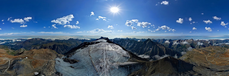
360° panorama by Bruno Keiser. Click the image to open the interactive version.
Only a few days before polar day, the sun does its best to provide proper spring feeling and temperatures, eventhough there are still remains left from a long winter in northern Lapland.
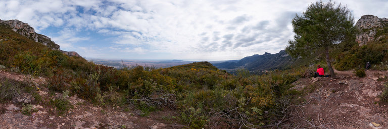
360° panorama by Vicente Soler. Click the image to open the interactive version.
El Cavall Bernat, belongs to the Sierra de Corbera, a mountain barrier from which we see the sea
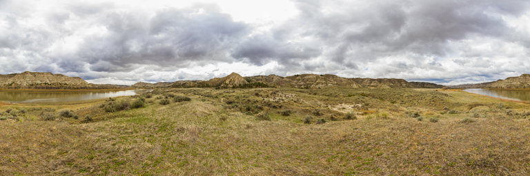
360° panorama by Ken Stahley. Click the image to open the interactive version.
This view is typical of the Missouri Breaks along the banks of the Missouri River central Montana. The "Breaks" are highly eroded hills and bluffs the spill into the Missouri River. The tops of the breaks are often open grasslands but heavy arid pine forests are also common. The breaks have an elevation up to 800' (240m) above the river.
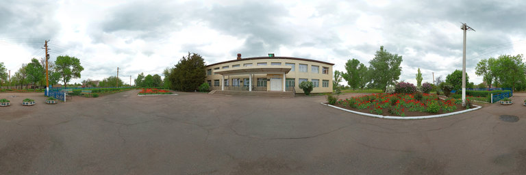
360° panorama by Ruslan Tkachenko. Click the image to open the interactive version.
Україна, Запорізька обл., Веселівський р-н, село Новоуспенівка, ВУЛИЦЯ ШКІЛЬНА, будинок 19
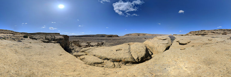
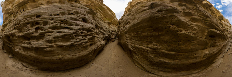
360° panorama by Ken Stahley. Click the image to open the interactive version.
This slot canyon, and a smaller adjacent one, are found at the head of Neat Coulee near the Eagle Creek camping area along the Missouri River. The slot canyon is eroded by water cutting down through the soft Virgelle Sandstone.
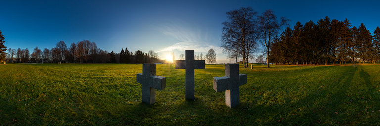
360° panorama by Andrew Bodrov. Click the image to open the interactive version.
The Maarjam"ae War Memorial was built partly over a war cemetery housing 2300 German dead, dating from 1941. The cemetery was rededicated in 1998 and is now delineated by sets of triple granite crosses in the style common to German WWII military cemeteries throughout Europe.