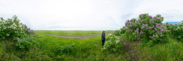
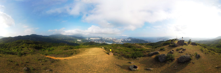
Добавить любой RSS - источник (включая журнал LiveJournal) в свою ленту друзей вы можете на странице синдикации.
Исходная информация - http://www.360cities.net/. Данный дневник сформирован из открытого RSS-источника по адресу http://www.360cities.net/rss/rss.xml, и дополняется в соответствии с дополнением данного источника. Он может не соответствовать содержимому оригинальной страницы. Трансляция создана автоматически по запросу читателей этой RSS ленты. По всем вопросам о работе данного сервиса обращаться со страницы контактной информации.[Обновить трансляцию]
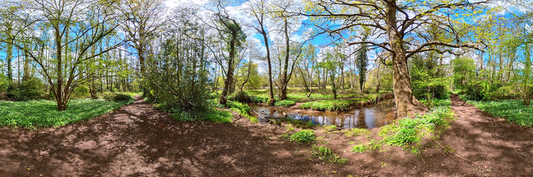
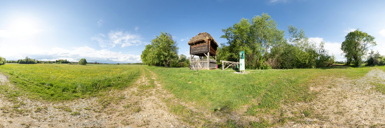
360° panorama by Andy Newman. Click the image to open the interactive version.
Garlic smelling Ramsons flowers (Allium Ursinum) bordering the winding stream though Flexford Nature Reserve run by Hampshire & Isle of White Trust in chandlers Ford, Hampshire United Kingdom
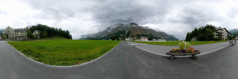
360° panorama by Isabel Marques. Click the image to open the interactive version.
Panorama photographed on the Via da Baselgia between the Engiadinaisa Library and the Hotel Alpenrose next to huge green fields. Sils Baselgia grew up around the church of Saint Laurent.
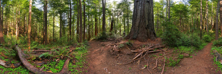
360° panorama by William l. Click the image to open the interactive version.
While redwoods are found mostly along the Northern California Coast, there are two groves of redwoods in the southwestern corner of Oregon. This one is located on Peavine Ridge & hosts a number of giant trees up to 250 feet in height. The largest ones here are up to ten feet in width though are much smaller than their neighbors to the south. A loop trail follows the ridge while a longer trail follows through a predominantly younger forest.
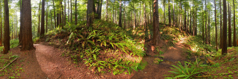
360° panorama by William l. Click the image to open the interactive version.
While redwoods are found mostly along the Northern California Coast, there are two groves of redwoods in the southwestern corner of Oregon. This one is located on Peavine Ridge & hosts a number of giant trees up to 250 feet in height. The largest ones here are up to ten feet in width though are much smaller than their neighbors to the south. A loop trail follows the ridge while a longer trail follows through a predominantly younger forest. Here on the longer trail this scene shows almost entirely all redwood trees, though these trees are small to medium in size.
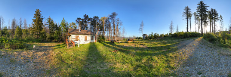
360° panorama by William l. Click the image to open the interactive version.
Packers Cabin is located above the Chetco River on a ridge northeast of Brookings, Oregon. It was built in the 1930s for the Forest Service packer to supply goods to nearby fire lookouts via mules & horses. The area was surrounded by the Chetco Bar Fire in 2017 but the cabin survived from extensive watering of the grounds, though a nearby shed appears destroyed. Today the cabin appears boarded up & in slow decay.
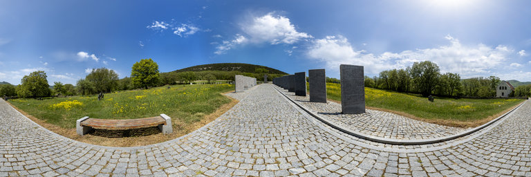
360° panorama by Kolesnikov Sergey. Click the image to open the interactive version.
The German soldiers' cemetery near the village of Goncharnoye was created in 1999 at the initiative of the German People's Union for the Care of War Graves (VDK e.V.). On the stone slabs along the path, the names of 25 thousand victims are inscribed. Some of the slabs are only partially filled with names - this cemetery is active and the bodies of identified German soldiers from all over the Crimea are still brought here. There are no gravestones in the cemetery, only in a few places there are small stone crosses. The whole meadow is one big grave. Only the caretaker knows who and where lies, and the exact burial place is found according to a special book, where the names of the deceased are painted by meters. In addition to monuments to German soldiers, the cemetery has a memorial dedicated to prisoners of war and interned Germans. Commemorative books, as well as some belongings of the victims, are kept in the caretaker's house, on the ground floor of which a small museum corner was made. The Sevastopol-Goncharnoye war burial is funded from Germany through voluntary donations to the VDK fund. 30% of the fund's resources go to the maintenance of the graves of Soviet soldiers in Germany. Немецкое солдатское кладбище возле села Гончарное, было создано в 1999-ом году по инициативе Немецкого Народного Союза по уходу за воинскими захоронениями (VDK e.V.). На стоящих вдоль дорожки каменных плитах начертаны имена 25 из 200 тысяч погибших в Крыму немцев. Некоторые из плит заполнены именами лишь частично - это кладбище действующее и сюда до сих пор привозят останки опознанных немецких солдат со всего Крыма. Надгробий на кладбище нет, лишь в нескольких местах стоят небольшие каменные кресты. Весь луг является одной большой могилой. Кто и где лежит знает только смотритель, а точное место захоронения находят по специальной книге, где по метрам расписаны имена усопших. Кроме памятников немецким солдатам на кладбище есть мемориал, посвященный военнопленным и интернированным немцам. Памятные книги, как и некоторые вещи погибших хранятся в домике смотрителя, на первом этаже которого был сделан небольшой музейный уголок. Военное захоронение Севастополь-Гончарное финансируется из Германии за счет добровольных пожертвований в фонд VDK. 30% средств фонда идет на содержание могил советским воинам в Германии.
360° panorama by Ken Stahley. Click the image to open the interactive version.
Neat Coulee drains into the Missouri River near the Eagle Creek Campground. Neat Coulee is a short, heavily eroded, small slot canyon. In this panorama the canyon has narrowed but is still not a slot canyon. The White Cliffs of sandstone are soft and erode easily. At this location in Neat Coulee an arch has formed high in a cliff while next to it the end of the cliff has eroded to form a large, lone hoodoo.
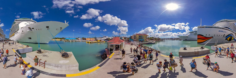
360° panorama by Willy Kaemena. Click the image to open the interactive version.
At the busy Cruise Ship Terminal of St. John's Antigua Caribbean Nov. 2018
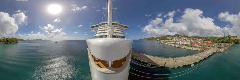
360° panorama by Willy Kaemena. Click the image to open the interactive version.
AIDAperla Cruise Ship on it's first voyage to the Caribbean in Nov. 2018. in the port of St. George's Grenada
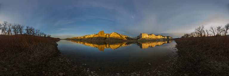
360° panorama by Ken Stahley. Click the image to open the interactive version.
Sunset on the White Cliffs across the Missouri River from the Eagle Creek Campground turns the cliffs to a bright orange. Mingled among the white sandstone is a black igneous intrusion. Eagle Creek CG is located on an easement of private land in an area where there are many hiking opportunities to view the eroded features of the White Cliffs. In fact, there are a couple of very nice slot canyons nearby.