Добавить любой RSS - источник (включая журнал LiveJournal) в свою ленту друзей вы можете на странице синдикации.
Исходная информация - http://www.360cities.net/. Данный дневник сформирован из открытого RSS-источника по адресу http://www.360cities.net/rss/rss.xml, и дополняется в соответствии с дополнением данного источника. Он может не соответствовать содержимому оригинальной страницы. Трансляция создана автоматически по запросу читателей этой RSS ленты. По всем вопросам о работе данного сервиса обращаться со страницы контактной информации.[Обновить трансляцию]
360° panorama by Andrew Bodrov. Click the image to open the interactive version.
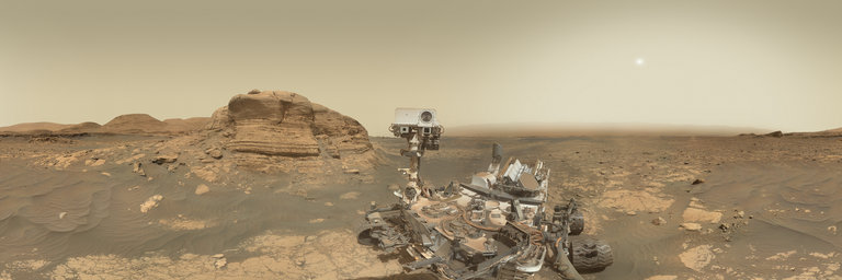
NASA's Mars Exploration Program (Image credit: NASA/JPL-Caltech/MSSS) Sols 3069-3070: Smile! The images for panorama obtained by the rover's taken by the rover's Mars Hand Lens Imager (MAHLI). The mosaic, which stretches about 30,000 pixels width, includes 60 images taken on Sol 3070 (March 25, 2021). With a successful drill campaign at “Nontron” in the books, the team continued to wrap up drill hole observations and also grab some final observations of the interesting materials that mark this area. ChemCam will acquire a passive spectra of sulfate-bearing buttes beckoning to us from farther up "Mount Sharp." Mastcam will image the sand targets “Thenac” and “Thenon” to look for wind-induced changes, and the target “Creyssac,” a coherent crack in nearby sand to watch how - or if - it changes. Mastcam and Navcam will both monitor the amount of dust in the atmosphere, and Navcam will acquire a movie looking for dust devils. RAD, REMS, and DAN maintain their steady watch over the Gale crater environment through the plan. MAHLI will image both spots that APXS analyzed on the pile of discarded Nontron drill sample in the last plan. After the Nontron sample, MAHLI will team up with APXS for a multi-spot analysis, or raster, on the “Chassenon” target. We most commonly associate rasters with ChemCam, as moving through multiple spots in succession - sometimes in a grid, sometimes in a line - is how ChemCam analyzes a given target. Such rasters take 20-30 minutes, depending on the number of points in the raster. A raster with APXS and MAHLI takes much longer! MAHLI and APXS are both at the end of the rover arm, so each MAHLI image and each APXS analysis relies on the arm and turret to gently and accurately place the instruments where the science team wants them to go. Those arm motions are slow and careful, as you would expect if you were operating a 2-meter long arm weighing nearly 100 kilograms! The resulting data, though, make the effort worth it. The Chassenon target is the white-gray-white striped feature at the edge of the bedrock block to the left of the drill hole in the image above. If we only obtained a single APXS analysis over the center of Chassenon, the resulting chemistry would be a mix of that of the feature, the sand to its left, and the bedrock to its right. By adding two additional analyses - one slightly shifted off the center to get a mix of the feature and the surrounding bedrock, one over only bedrock - we can better isolate the chemistry of the feature. That is done by combining the chemistry from the APXS analyses with the proportions of materials in each APXS field of view, as determined with the MAHLI images that accompany each APXS analysis. The manner in which the chemistry varies with those proportions allows the chemistries of the individual materials to be separated. We anticipate leaving our Nontron drill site in the next few sols, and just as you might snap one last picture of a memorable vacation spot, MAHLI will wrap up the plan with a rover selfie featuring the spectacular “Mont Mercou” in the background. Smile, Curiosity! by Michelle MinittiPlanetary Geologist at Framework Other panoramas of Mars by Curiosity rover: http://www.360cities.net/sets/curiosity-mars
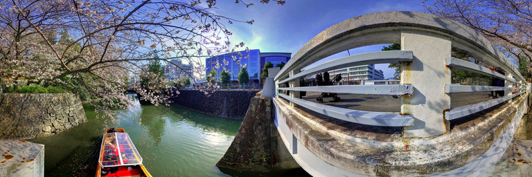
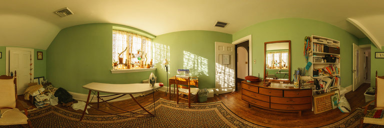
360° panorama by Ricardo Pi. Click the image to open the interactive version.
The Almonacid de la Cuba Dam was a Roman gravity dam in Almonacid de la Cuba, Zaragoza province, Aragon, Spain, dating to the 1st century AD. (WIKIPEDIA)
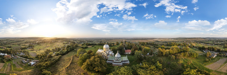
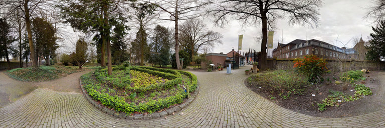
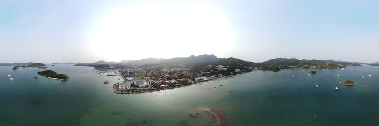
360° panorama by Patricia M"uller. Click the image to open the interactive version.
Tegelen Steyl Jochumhof Botanical Yard This botanical yard is part of the Steyl cloister village. Follow the yellow brick road and you will find a cafe and a glasshouse full of cactus plants, but may be you also will have an encounter with Dorothy, the cowardly lion and the tin man. Who knows? Tegelen Steyl Jochumhof Dieser botanische Garten ist Teil des Klosterdorfes Steyl. Folgen Sie der gelben Ziegelsteinstrasse und Sie finden ein Caf'e und ein Gew"achshaus voller Kakteen, aber vielleicht begegnen Sie ja auch Dorothy, dem feigen L"owen und dem Blechmann. Wer weiss?
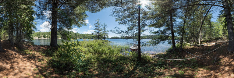
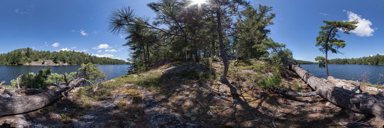
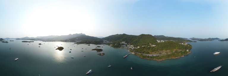
360° panorama by Thomas K Sharpless. Click the image to open the interactive version.
On the third day of Spring, 2021, we finally have bright morning sun.
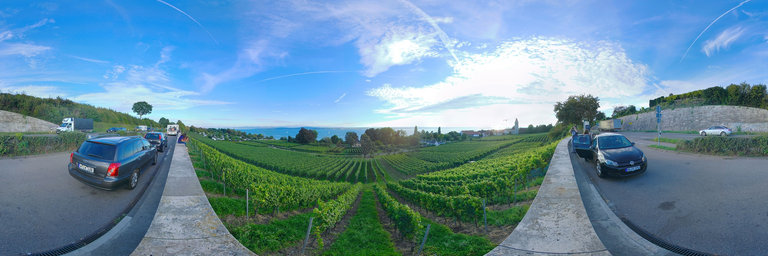
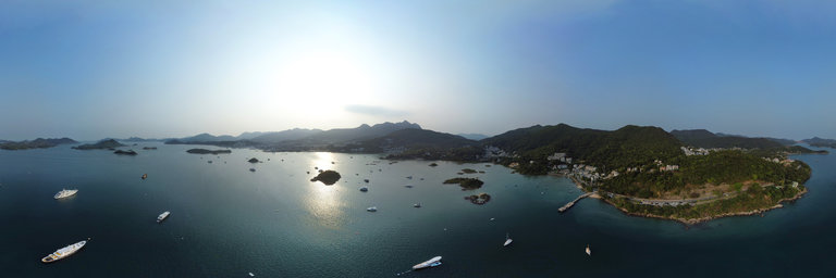
360° panorama by Klaus Mayer. Click the image to open the interactive version.
Sunset views across vineyards and Lake Constance towards the Swiss Alps at Hagnau, Baden-Wuerttemberg, Germany. Lake Constance is a 63 kilometre long lake bordering Austria, Germany and Switzerland.
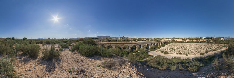
360° panorama by Vicente Mas.. Click the image to open the interactive version.
Sobre la antigua carretera a la estaci'on de ferrocarril de Crevillente (Alicante) se encuentra este acueducto construido en la segunda d'ecada del siglo pasado por la Sociedad riegos de Levante para el agua de riego del segundo canal de poniente.