Добавить любой RSS - источник (включая журнал LiveJournal) в свою ленту друзей вы можете на странице синдикации.
Исходная информация - http://www.360cities.net/. Данный дневник сформирован из открытого RSS-источника по адресу http://www.360cities.net/rss/rss.xml, и дополняется в соответствии с дополнением данного источника. Он может не соответствовать содержимому оригинальной страницы. Трансляция создана автоматически по запросу читателей этой RSS ленты. По всем вопросам о работе данного сервиса обращаться со страницы контактной информации.[Обновить трансляцию]
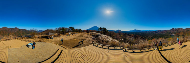
360° panorama by kiyoharu takamura. Click the image to open the interactive version.
You can see three of five lakes that they are called Fujigoko. Unfortunately, Lake Kawaguchi is no visible in this panorama. So this place is named "Sankodai". "Sanko" is means three lakes. "-dai" is means small hill. It takes half a hour from Kouyoudai's parking by walk.
360° panorama by William l. Click the image to open the interactive version.
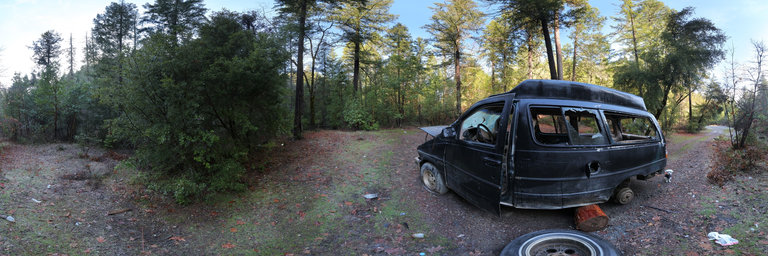
Another trashed vehicle jackpot, this one located up Star Gulch Road near McKee Bridge, Oregon. A vin number on the driver's side gave me some info of it being a 1992 Ford Aerostar minivan, assembled in Hazelwood (St. Louis area), Missouri. Ford Aerostars were in production from June 15, 1985 to August 22, 1997. The ultimate van by the river, or in this case, creek.
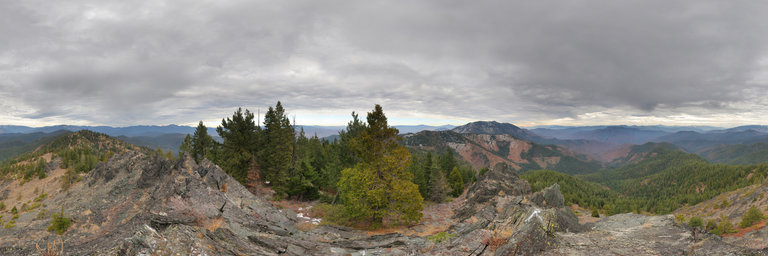
360° panorama by William l. Click the image to open the interactive version.
Gigapixel view from the summit of Shaft Rock (elev. 5,741') southwest of Hilt, California. The mountain is on a high ridge that culminates to nearby Cottonwood Peak. Here amidst a storm that was bringing in the winds, one can see the tip of Mount Shasta behind Cottonwood Peak, Black Butte, Mount Eddy, the Marble Mountain Wilderness, Tom Martin Peak, the Siskiyou Mountains in Oregon (including Dutchman Peak & Mount Ashland), & east towards the Shasta Valley & Goosenest. I'm not sure about the naming but the peak does have a number of steep outcroppings & spires on the south slopes. Gigapixel panorama (1.406 gigapixels), 304 photos, 53036x26518 pixels
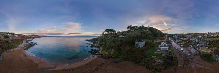
360° panorama by Mariusz Kalinowski. Click the image to open the interactive version.
Myrtleville is a small seaside village in County Cork, Ireland. 18th and 19th century records of the local estate houses associate Myrtleville House with the Daunt family. The village lies within the townlands of Ballinluska and Myrtleville, just west of the entrance to Cork Harbour.Wikipedia
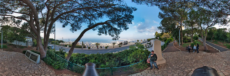
360° panorama by Sergey Sirotkin. Click the image to open the interactive version.
Walk with friends near the hotel in Haifa. We saw a beautiful view of the seaport.