Добавить любой RSS - источник (включая журнал LiveJournal) в свою ленту друзей вы можете на странице синдикации.
Исходная информация - http://www.360cities.net/. Данный дневник сформирован из открытого RSS-источника по адресу http://www.360cities.net/rss/rss.xml, и дополняется в соответствии с дополнением данного источника. Он может не соответствовать содержимому оригинальной страницы. Трансляция создана автоматически по запросу читателей этой RSS ленты. По всем вопросам о работе данного сервиса обращаться со страницы контактной информации.[Обновить трансляцию]
Воскресенье, 20 Декабря 2020 г. 22:17
+ в цитатник
360° panorama by Santiago Ribas - 360portugal. Click the image to open the interactive version.
This Lagoon is of glacier origin and is located in the Vale da Candeeira basin at 1670m altitude. This Lagoon is of glacier origin and is located in the Vale da Candeeira basin at 1670m altitude
Воскресенье, 20 Декабря 2020 г. 22:12
+ в цитатник
360° panorama by Santiago Ribas - 360portugal. Click the image to open the interactive version.
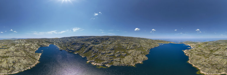
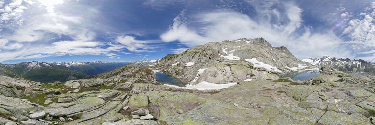
In general, the covons in Serra da Estrela correspond to glacial basins of over-excavation, that is, they are depressed and poorly drained areas, in whose bottom, after the glacier retreat, sediments accumulated, which allowed the development of peat and soils. vegetation. This filling of fine materials is visible in Cov~ao da Ametade which is one of the most imposing caves in the Estrela Geopark. Downstream, Cov~ao da Albergaria, has a genesis identical to Cov~ao da Ametade, but with a greater accumulation of blocks that collapsed from the slopes.
Воскресенье, 20 Декабря 2020 г. 22:09
+ в цитатник
360° panorama by Santiago Ribas - 360portugal. Click the image to open the interactive version.
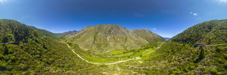
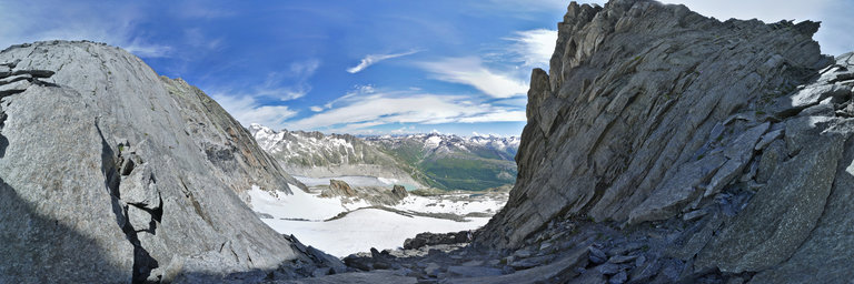
The Z^ezere valley is a perfect example of the strength of glaciers to sculpt landscapes. With a 10 km long U-shaped cross-section between Cov~ao da Ametade and the town of Manteigas, the valley has a succession of covons, glacier bolts and suspended valleys in its upstream sector, and several types of glacial deposits , fluvioglacial and slope. At the height of the last glaciation, the glacier reached a thickness of 340 meters here, fed by the ice field of the Plateau da Torre. A little further downstream, the Z^ezere valley was also fed by glaciers from the suspended valleys of Candieira and Cov^oes (GF31). The deepening of the current valley and its rectilinear character result from the erosion having been facilitated along the great tectonic alignment that is the fault of Braganca-Vilarica-Manteigas-Unhais da Serra.
Воскресенье, 20 Декабря 2020 г. 22:04
+ в цитатник
360° panorama by Santiago Ribas - 360portugal. Click the image to open the interactive version.
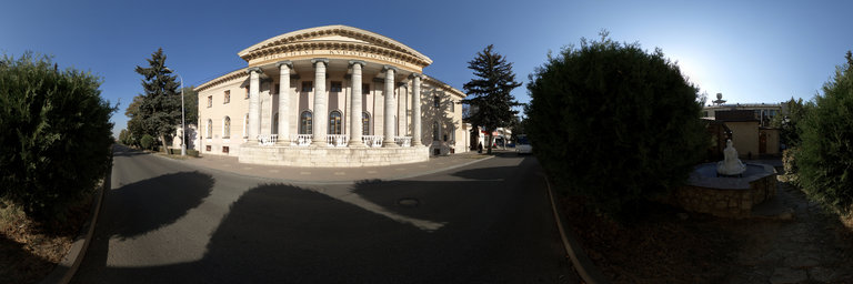
It was one of the first Pousadas de Portugal, an absolutely innovative concept of small hotels “that don't look like hotels”, very welcoming, in which guests could feel the true hospitality, the beauty of the Portuguese landscape, the delights of the local gastronomy… “ Rustic comfort, good taste, easy to arrange and taste, lovely simplicity… and poetry, some poetry… ”, as in 1943 its author said. This Pousada was part of the government's project to create a national network of regional inns. It was a matter of creating in each inn, with its originality and the characteristics of each region, a homely atmosphere without luxuries, a calm, familiar and Portuguese atmosphere. In 1945 The government's Tourism Office initiates a tourism promotion campaign, with itineraries and tourist guides in different languages. old inn
Воскресенье, 20 Декабря 2020 г. 19:59
+ в цитатник
360° panorama by Santiago Ribas - 360portugal. Click the image to open the interactive version.
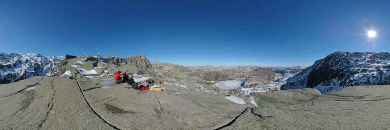
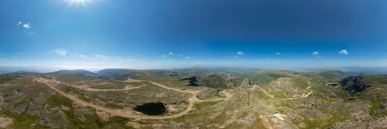
Cov~ao Cimeiro is an amphitheater with abrupt walls, with slopes that reach up to 300m. It is one of the most spectacular examples of the glacier circus of Serra da Estrela. It is an example of a glacier landscape, and its characteristic of being excavated and poorly drained is called ombilic. The convex rock that almost closes the depression is called verrou, which in Portuguese is called the Glaci'arico bolt. Its almost polished side surface is due to the abrasion caused by the mass of ice over 300m high, which moved towards the Vale do Z^ezere.
Воскресенье, 20 Декабря 2020 г. 19:23
+ в цитатник
360° panorama by Santiago Ribas - 360portugal. Click the image to open the interactive version.
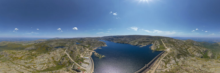
Lagoa Comprida, was an old glacier lake with 1km of extension. Taking advantage of the cov~ao, the construction of the dam began in 1912. In 1914, it had a height of 6 meters and in 1934 it reached 15 meters. It currently has a height of 28 meters, with elevation works done in 1965. It is a gravity type dam, formed by 3 granite masonry arches, with 1200m of development. The volume of masonry is over 100,000 m3. The reservoir has a capacity of about 14,000,000m3 of water, flooding an area of 811,614 m2. The slope basin is 13.5km2. In this reservoir two tunnels flow; the one of Cov~ao do Meio, of 2354m, that diverts the waters of the slopes of the Tower, and the one of Conchos, with 1519m that diverts the waters of the Ribeira das Naves. Length of 2100m and width between 840-250m
Воскресенье, 20 Декабря 2020 г. 19:22
+ в цитатник
360° panorama by Santiago Ribas - 360portugal. Click the image to open the interactive version.
Lagoa Comprida, was an old glacier lake with 1km of extension. Taking advantage of the cov~ao, the construction of the dam began in 1912. In 1914, it had a height of 6 meters and in 1934 it reached 15 meters. It currently has a height of 28 meters, with elevation works done in 1965. It is a gravity type dam, formed by 3 granite masonry arches, with 1200m of development. The volume of masonry is over 100,000 m3. The reservoir has a capacity of about 14,000,000m3 of water, flooding an area of 811,614 m2. The slope basin is 13.5km2. In this reservoir two tunnels flow; the one of Cov~ao do Meio, of 2354m, that diverts the waters of the slopes of the Tower, and the one of Conchos, with 1519m that diverts the waters of the Ribeira das Naves. Length of 2100m and width between 840-250m
Воскресенье, 20 Декабря 2020 г. 19:12
+ в цитатник
360° panorama by Santiago Ribas - 360portugal. Click the image to open the interactive version.
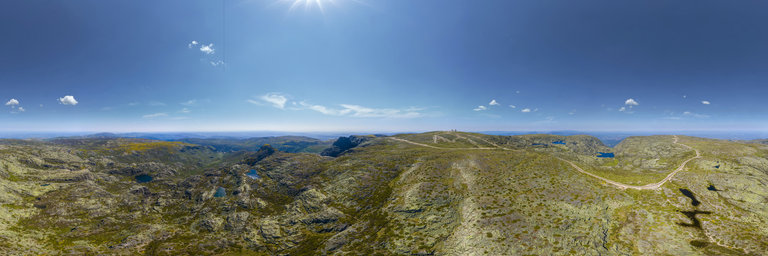
On this flat surface, very humid and favorable to snowfall, a period of ice known as the Upper Plistocene (2 million to 20,000 years ago) developed between the Torre plateau and the Curral Matins area and Vale do Conde to the north. This cap, about 80 meters high, fed the various valley glaciers that developed around it. Most of the Planalto da Torre is constituted by an erosion area, without any superficial deposit, and the ice transported the materials resulting from the alterations previous to the Glacier period. All this granite that was visible, in contact with the fluctuations in daily and seasonal temperatures, fractures in parallel, forming slabs.
Воскресенье, 20 Декабря 2020 г. 19:08
+ в цитатник
360° panorama by Santiago Ribas - 360portugal. Click the image to open the interactive version.
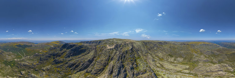
To the north and south of Cov~ao Cimeiro are the Gordo and Magro pitchers, two massive rocky elevations and vertical escarpments, whose tops emerged from the glacier in the last glaciation. The groove in the valleys was essentially controlled by the higher fracture density, with the less fractured areas being in an over-elevated position, due to their greater resistance. The upper sections of the slopes of the pitchers, evolved essentially by cryoclastic processes and by landslides, after the glacier retreat.
Воскресенье, 20 Декабря 2020 г. 19:07
+ в цитатник
360° panorama by Santiago Ribas - 360portugal. Click the image to open the interactive version.
A norte e a sul do Cov~ao Cimeiro encontram-se os c^antaros Gordo e Magro, duas elevac~oes rochosas macicas e de escarpas verticais, cujos topos emergiam do glaciar na 'ultima glaciac~ao. O entalhe dos vales foi essencialmente controlado pela maior densidade de fracturac~ao, ficando as 'areas menos fracturadas em posic~ao sobre-elevada, devido `a sua maior resist^encia. Os trocos superiores das vertentes dos c^antaros, evolu'iram essencialmente por processos criocl'asticos e por desabamentos, ap'os o retrocesso glaci'arico.
Воскресенье, 20 Декабря 2020 г. 18:09
+ в цитатник
360° panorama by Santiago Ribas - 360portugal. Click the image to open the interactive version.
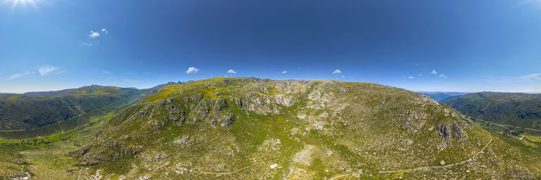
On this flat surface, very humid and favorable to snowfall, a period of ice known as the Upper Plistocene (2 million to 20,000 years ago) developed between the Torre plateau and the Curral Matins area and Vale do Conde to the north. This cap, about 80 meters high, fed the various valley glaciers that developed around it. Most of the Planalto da Torre is constituted by an erosion area, without any superficial deposit, and the ice transported the materials resulting from the alterations previous to the Glacier period. All this granite that was visible, in contact with the fluctuations in daily and seasonal temperatures, fractures in parallel, forming slabs. The study of the Serra da Estrela glaciation started in 1884 by Vasconcelos Pereira Cabral, but it was the detail of the study by the German geographer Hermann Lautensach of 1932 that brought more knowledge to the Serra da Estrela Glaciation process. In 1971 Suzanne Daveau published the results of new investigations on the Serra da Estrela Glaciation. In 1997, the topic returned to interest the researchers, they are in a perliminary phase. According to Lautensach, the distribution of the ice sheet at the top of Serra da Estrela would have an asymmetrical west-east profile, with more ice rising on the east side, due to the prevailing winds of that time coming from the west quadrant. The relief of the nascent part of the Central Massif of Serra da Estrela has broader and deeper glacial erosion forms, formed either by circuits or glacial valleys.
Воскресенье, 20 Декабря 2020 г. 18:06
+ в цитатник
360° panorama by Santiago Ribas - 360portugal. Click the image to open the interactive version.
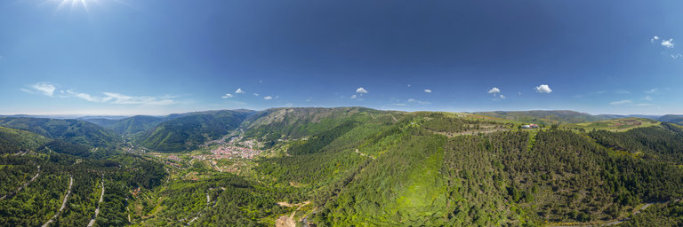
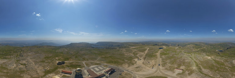
Highest point in mainland Portugal, where D. Jo~ao VI (1816-1826) ordered the erection of a stone tower, to complement the 2000m. From this point, the view reaches culminating points, from the Serra da Boa Viagem in Buarcos, to the Serra de Gredos in Spain, from the Mar~ao in Tr'as-os-Montes to the Serra de Portalegre in the Alentejo. In the 1950s, Air Force facilities were built, which housed the radar. They were deactivated in 1970. Currently, it is a sales center and information center.