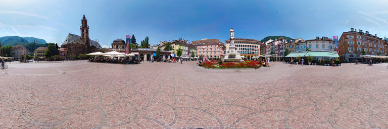
Добавить любой RSS - источник (включая журнал LiveJournal) в свою ленту друзей вы можете на странице синдикации.
Исходная информация - http://www.360cities.net/. Данный дневник сформирован из открытого RSS-источника по адресу http://www.360cities.net/rss/rss.xml, и дополняется в соответствии с дополнением данного источника. Он может не соответствовать содержимому оригинальной страницы. Трансляция создана автоматически по запросу читателей этой RSS ленты. По всем вопросам о работе данного сервиса обращаться со страницы контактной информации.[Обновить трансляцию]
360° panorama by Ken Stahley. Click the image to open the interactive version.
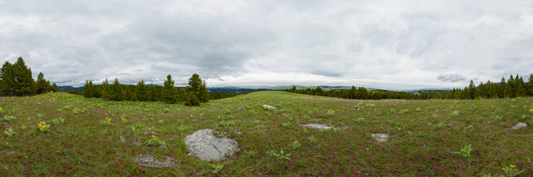
A hike of about a mile from the Smith River elevates one to the hills that surround the canyon. This spring photo shows a myriad of wildflowers including the pink Shooting Stars and the yellow Arrow Leaf Balsamroot. The distant hills still retain just a bit of snow.
360° panorama by Ken Stahley. Click the image to open the interactive version.
A hike of about a mile from the Smith River elevates one to the hills that surround the canyon. This spring photo shows a myriad of wildflowers including the pink Shooting Stars and the yellow Arrow Leaf Balsamroot. The distant hills still retain just a bit of snow.
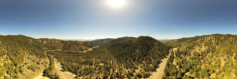
360° panorama by Klaus Mayer. Click the image to open the interactive version.
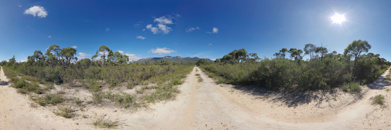
Views of Victoria Range from Serra Road in Grampians National Park, Victoria, Australia. Serra Road crosses Teddy Bear Gap on the Serra Range connecting the sealed Grampians Road with the unsealed Syphon Road which runs along Victoria Range.
360° panorama by Klaus Mayer. Click the image to open the interactive version.
Views of Victoria Range from Serra Road in Grampians National Park, Victoria, Australia. Serra Road crosses Teddy Bear Gap on the Serra Range connecting the sealed Grampians Road with the unsealed Syphon Road which runs along Victoria Range.
360° panorama by Norm Olson. Click the image to open the interactive version.
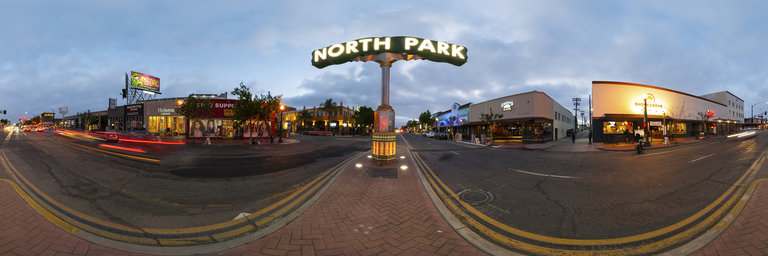
The center of the North Park neighborhood in San Diego, California, USA is at 30th Street and University Avenue. The large lit sign, in the middle of the street, is one of the iconic signs in the city.
360° panorama by Norm Olson. Click the image to open the interactive version.
The center of the North Park neighborhood in San Diego, California, USA is at 30th Street and University Avenue. The large lit sign, in the middle of the street, is one of the iconic signs in the city.
360° panorama by Norm Olson. Click the image to open the interactive version.
The center of the North Park neighborhood in San Diego, California, USA is at 30th Street and University Avenue. The large lit sign, in the middle of the street, is one of the iconic signs in the city.
360° panorama by Gary Davies. Click the image to open the interactive version.
A classic Norman motte-and-bailey castle built in the 1070s by William de Warenne, who fought alongside William the Conqueror at the Battle of Hastings, during the Norman Conquest. The family developed the original fortified house, founded the surrounding village, and also the nearby Castle Acre Priory. The castle was reported as derelict by 1397 with the ruins serving as a quarry and stockade for cattle for several centuries.
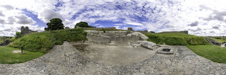