Добавить любой RSS - источник (включая журнал LiveJournal) в свою ленту друзей вы можете на странице синдикации.
Исходная информация - http://www.360cities.net/. Данный дневник сформирован из открытого RSS-источника по адресу http://www.360cities.net/rss/rss.xml, и дополняется в соответствии с дополнением данного источника. Он может не соответствовать содержимому оригинальной страницы. Трансляция создана автоматически по запросу читателей этой RSS ленты. По всем вопросам о работе данного сервиса обращаться со страницы контактной информации.[Обновить трансляцию]
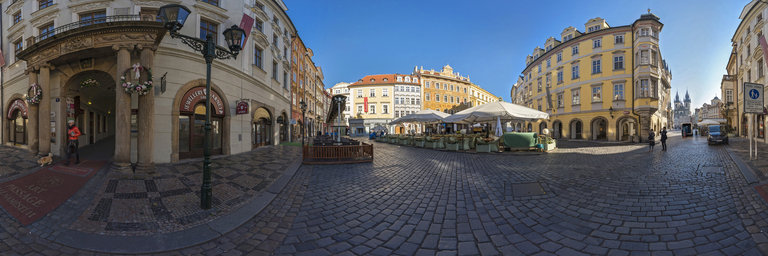
360° panorama by Andrew Bodrov. Click the image to open the interactive version.
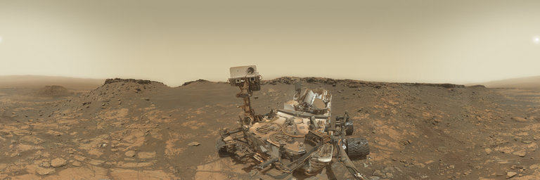
NASA's Mars Exploration Program (Image credit: NASA/JPL-Caltech/MSSS) Sol 2687: The Tail End of the Hutton Drill Campaign This panorama combines 85 exposures taken by the rover's Mars Hand Lens Imager (MAHLI) during the Sol 2687 of Curiosity's work on Mars (February 27, 2020) We’re wrapping up our Hutton drill campaign literally at the tail end. Specifically, today’s plan focused on studying those drill “tailings”. This phase of the drill campaign helps compare the SAM and CheMin laboratory analyses with the data from our remote sensing instruments of the same material from the drill hole. It’s always interesting to see that Mars’ red color is sometimes literally only skin-deep and underneath can be much more of a lunar gray. We also packed in a few additional observations of some nearby rock targets, including an intriguing fin-like structure sticking out of the ground nearby called “Dunbartonshire.” We’ll look at it also with MAHLI and APXS on the second night of our 2-sol plan. ENV included a dust devil movie, but has been unable to do much additional long-distance imaging work at our current location due to the cliff surrounding us on three sides blocking our view in most directions. Written by Scott GuzewichAtmospheric Scientist at NASA's Goddard Space Flight Center Other panoramas of Mars by Curiosity rover: http://www.360cities.net/sets/curiosity-mars
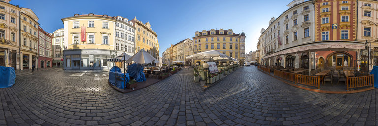
360° panorama by Andrew Bodrov. Click the image to open the interactive version.
NASA's Mars Exploration Program (Image credit: NASA/JPL-Caltech/MSSS) Sol 2687: The Tail End of the Hutton Drill Campaign This panorama combines 85 exposures taken by the rover's Mars Hand Lens Imager (MAHLI) during the Sol 2687 of Curiosity's work on Mars (February 27, 2020) We’re wrapping up our Hutton drill campaign literally at the tail end. Specifically, today’s plan focused on studying those drill “tailings”. This phase of the drill campaign helps compare the SAM and CheMin laboratory analyses with the data from our remote sensing instruments of the same material from the drill hole. It’s always interesting to see that Mars’ red color is sometimes literally only skin-deep and underneath can be much more of a lunar gray. We also packed in a few additional observations of some nearby rock targets, including an intriguing fin-like structure sticking out of the ground nearby called “Dunbartonshire.” We’ll look at it also with MAHLI and APXS on the second night of our 2-sol plan. ENV included a dust devil movie, but has been unable to do much additional long-distance imaging work at our current location due to the cliff surrounding us on three sides blocking our view in most directions. Written by Scott GuzewichAtmospheric Scientist at NASA's Goddard Space Flight Center Other panoramas of Mars by Curiosity rover: http://www.360cities.net/sets/curiosity-mars
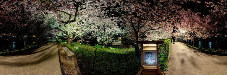
360° panorama by Andrew Bodrov. Click the image to open the interactive version.
NASA's Mars Exploration Program (Image credit: NASA/JPL-Caltech/MSSS) Sol 2687: The Tail End of the Hutton Drill Campaign This panorama combines 85 exposures taken by the rover's Mars Hand Lens Imager (MAHLI) during the Sol 2687 of Curiosity's work on Mars (February 27, 2020) We’re wrapping up our Hutton drill campaign literally at the tail end. Specifically, today’s plan focused on studying those drill “tailings”. This phase of the drill campaign helps compare the SAM and CheMin laboratory analyses with the data from our remote sensing instruments of the same material from the drill hole. It’s always interesting to see that Mars’ red color is sometimes literally only skin-deep and underneath can be much more of a lunar gray. We also packed in a few additional observations of some nearby rock targets, including an intriguing fin-like structure sticking out of the ground nearby called “Dunbartonshire.” We’ll look at it also with MAHLI and APXS on the second night of our 2-sol plan. ENV included a dust devil movie, but has been unable to do much additional long-distance imaging work at our current location due to the cliff surrounding us on three sides blocking our view in most directions. Written by Scott GuzewichAtmospheric Scientist at NASA's Goddard Space Flight Center Other panoramas of Mars by Curiosity rover: http://www.360cities.net/sets/curiosity-mars
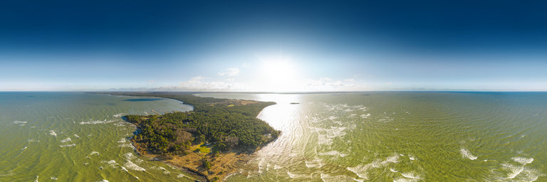
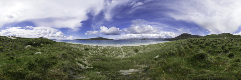
360° panorama by Gary Davies. Click the image to open the interactive version.
A long expanse of white sands set against turquoise waters and a spectacular mountainous backdrop has seen the beach at Luskentyre voted as one of the finest in the world. The areas of low lying grasses are known as Machair. They are one of the rarest habitats in Europe, found only on the exposed western coasts of Scotland and Ireland.
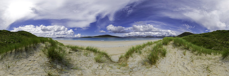