Добавить любой RSS - источник (включая журнал LiveJournal) в свою ленту друзей вы можете на странице синдикации.
Исходная информация - http://www.360cities.net/. Данный дневник сформирован из открытого RSS-источника по адресу http://www.360cities.net/rss/rss.xml, и дополняется в соответствии с дополнением данного источника. Он может не соответствовать содержимому оригинальной страницы. Трансляция создана автоматически по запросу читателей этой RSS ленты. По всем вопросам о работе данного сервиса обращаться со страницы контактной информации.[Обновить трансляцию]
360° panorama by Santiago Ribas - 360portugal. Click the image to open the interactive version.
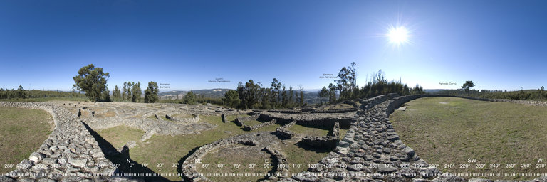
It is a Castro of Roman times, founded in the 1st / 1st century AD with an occupation period until the 5th / 5th century. Archaeological excavations began in 1943 to 1954, in a second phase from 1974 to 1979, continuing recently with archaeological campaigns. This fort was fortified with three lines of walls. The defensive walls adapt to the terrain, with regular planning. Of the possible twenty hectares, only 2 have been excavated. At the beginning of the castro, on the right side, we can see the base of a Roman Monument, from the 1st / 1st century AD, built in Flavian times that inside would have equestrian and human sculptures. It has a vast area of dwellings, with several types of constructions, from nuclei of houses with a traditional Castro patio, with circular compartments and vestibule, to the larger square or rectangular Roman dwellings.
360° panorama by Santiago Ribas - 360portugal. Click the image to open the interactive version.
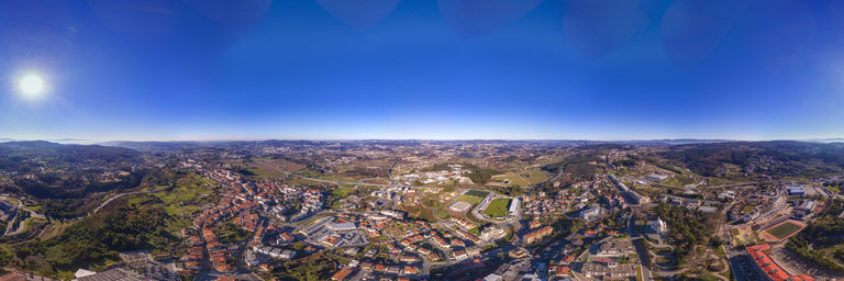
Castro de Monte Mozinho or the well-known Cidade Morta de Penafiel is located in the parishes of Oldr~oes and Galegos, in Monte Mozinho, Penafiel, district of Porto. It is the largest Castro Romano in the Iberian Peninsula, although it is not yet fully explored. Classified by IPPAR as a Property of Public Interest, as of September 29, 1948.
360° panorama by Santiago Ribas - 360portugal. Click the image to open the interactive version.
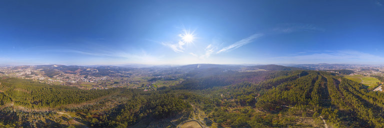
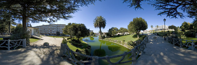
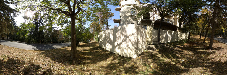
Park located at the highest point in the city. It was also at the base of this hill that the gallows were located in modern times. This elevation was transformed into a romantic forest within the scope of the construction project for the Sanctuary of Nossa Senhora da Piedade and dos Santos Passos by the engineer Jorge Pereira Leite to serve as a public park for leisure, rest and stroll, nicknamed Nossa Senhora da Piedade and , after completion, Parque Zeferino de Oliveira. The planting of large trees started in 1889, as well as the construction of various elements characteristic of these spaces, such as benches, a grotto, a bandstand and a bazaar of reinforced concrete gifts imitating trunks and cork oak branches, in use in time, and two wooden bridges. In 1897 the staircases, the fountain and the lakes were built and the water was channeled. The work slowed down until it gained new momentum in the 1920s with the action of the Pro-Penafiel Commission and Zeferino de Oliveira. New australians, plantains, acacias and oaks were planted, a small lake with fountain was built, the great central staircase leading to the sanctuary, the largest lake, designed by Companhia Hort'icola Portuense, and new banks were excavated. In the years 1950-1970, the large lake was drained and the Baile do Lago was held inside. Recent urban remodeling works have destroyed part of the main lake and shortened the garden space.
360° panorama by Santiago Ribas - 360portugal. Click the image to open the interactive version.
Park located at the highest point in the city. It was also at the base of this hill that the gallows were located in modern times. This elevation was transformed into a romantic forest within the scope of the construction project for the Sanctuary of Nossa Senhora da Piedade and dos Santos Passos by the engineer Jorge Pereira Leite to serve as a public park for leisure, rest and stroll, nicknamed Nossa Senhora da Piedade and , after completion, Parque Zeferino de Oliveira. The planting of large trees started in 1889, as well as the construction of various elements characteristic of these spaces, such as benches, a grotto, a bandstand and a bazaar of reinforced concrete gifts imitating trunks and cork oak branches, in use in time, and two wooden bridges. In 1897 the staircases, the fountain and the lakes were built and the water was channeled. The work slowed down until it gained new momentum in the 1920s with the action of the Pro-Penafiel Commission and Zeferino de Oliveira. New australians, plantains, acacias and oaks were planted, a small lake with fountain was built, the great central staircase leading to the sanctuary, the largest lake, designed by Companhia Hort'icola Portuense, and new banks were excavated. In the years 1950-1970, the large lake was drained and the Baile do Lago was held inside. Recent urban remodeling works have destroyed part of the main lake and shortened the garden space.
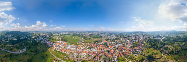
360° panorama by Santiago Ribas - 360portugal. Click the image to open the interactive version.
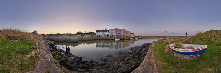
Penafiel until 1770 was called Arrifana de Sousa, already nicknamed in 1258. Until about the middle of the 16th century, Arrifana was only a place in the parish of S. Martinho de Moazares and its affirmation as headquarters and later urban development owes much to its location next to the medieval tradition road that connected Porto to the interior of the country, namely Tr'as-os-Montes and Beiras. This house that developed along that road, now Rua Direita, Rua do Carmo and Rua Alfredo Pereira, is still today the main feature of Penafiel; the houses of good stone stonework, balconies ornamented with wrought iron, and some emblazoned palaces. Integrated in the court of Penafiel, since the end of the 14th century that this place depended administratively on the Chamber of Porto, a situation that displeased its residents who asked the king for his rise to the category of town. This promotion was granted to them on March 14, 1741, ending their parish of S~ao Martinho, and part of that of Santiago de Subarrifana, with Juiz de Fora and the Orphans, and separate jurisdiction for the city of Porto.
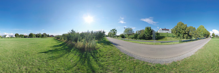
360° panorama by Klaus Mayer. Click the image to open the interactive version.
Panorama of manor house Hersberg and vineyards at Immenstaad, Baden-Wuerttemberg, Germany. Manor house Hersberg was originally a branch of the imperial abbey Ochsenhausen, then a princely grange and is now a pallottine educational institution.
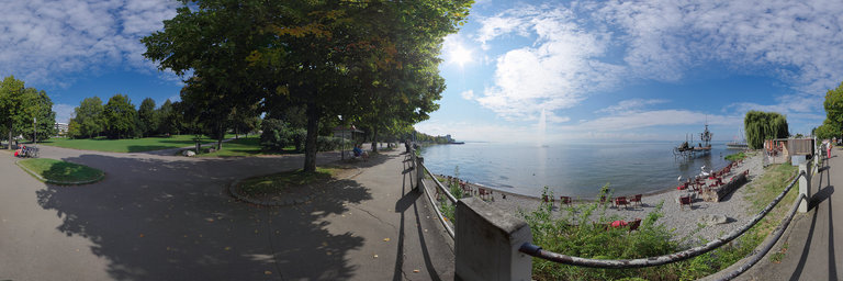
360° panorama by Klaus Mayer. Click the image to open the interactive version.
Zeppelin fountain and sculpture Klangschiff in Lake Constance at Friedrichshafen, Baden-Wuerttemberg, Germany. The sculpture contains symbolic figures from the Greek mythologie and was made during the war in former Yugoslavia and made its way along the Danube to Serbia. After a short stint in Sarajevo the sculpture was relocated to Friedrichshafen.
360° panorama by Ackermann, Michael. Click the image to open the interactive version.
Herbst am Mainufer Seligenstadt, im Hessischen Landkreis Offenbach, ist wohl eine der "altesten historischen Siedlungen am Main. Hier bauten bereits ca. 100 Jahre nach Christus die R"omer am so genannten nassen Limes ein Kastell. Um 840 fand Einhard, der Biograph des Kaisers Karl des Grossen, die Lage f"ur eine Benediktiner-Abtei ideal sei. So entstand die Klosteranlage mit dem grossen Konventgarten und im Umfeld viele Fachwerkh"auser. Micha
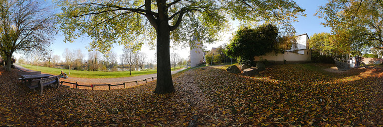