Добавить любой RSS - источник (включая журнал LiveJournal) в свою ленту друзей вы можете на странице синдикации.
Исходная информация - http://www.360cities.net/. Данный дневник сформирован из открытого RSS-источника по адресу http://www.360cities.net/rss/rss.xml, и дополняется в соответствии с дополнением данного источника. Он может не соответствовать содержимому оригинальной страницы. Трансляция создана автоматически по запросу читателей этой RSS ленты. По всем вопросам о работе данного сервиса обращаться со страницы контактной информации.[Обновить трансляцию]
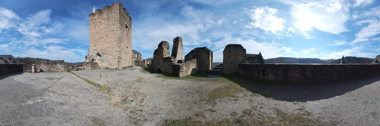
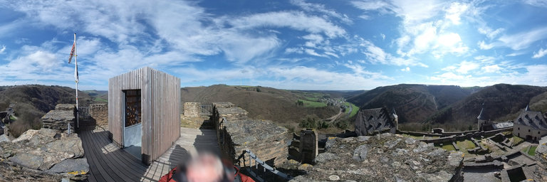
360° panorama by Jos Sanders. Click the image to open the interactive version.
Bourscheid Castle (Ch^ateau de Bourscheid, Buerg Buerschent) is located near the village of Bourscheid in north-eastern Luxembourg. The medieval castle stands on a site with archeological evidence of structures dating back to Roman times. Standing majestically some 150 metres (490 ft) above the River S^ure, it is enclosed by a circular wall with 11 watchtowers.
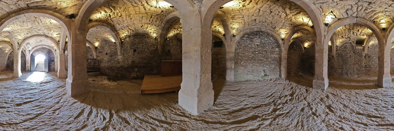
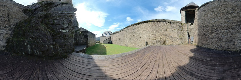
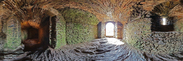
360° panorama by Gregory Perez. Click the image to open the interactive version.
A stand of flowering plums at the site of a now demolished work release facility at the El Dorado Lake State Park, El Dorado Kansas. Spring 2024
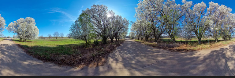
360° panorama by Gregory Perez. Click the image to open the interactive version.
A stand of flowering plums at the site of a now demolished work release facility at the El Dorado Lake State Park, El Dorado Kansas. Spring 2024
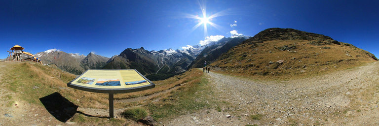
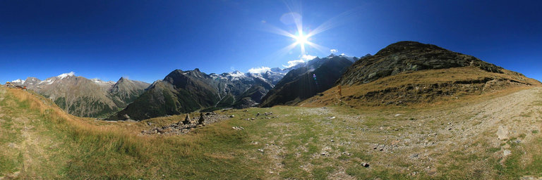
360° panorama by Isabel Marques. Click the image to open the interactive version.
Panorama photographed at Hannig mountain, Saas Fee in the Saastal Valley, Switzerland. The Hannigg mountain at 2336 m is reached on foot via the Sun Path or by gondola. It is also called Sunny Mountain because of its south-facing position, it receives a lot of sun and offers spectacular views of the Saastal mountains. At the end of Sun Path we find a friendly mountain restaurant with an excellent sunny terrace and a fun park for children. From here the landscape is magnificent, both in the village of Saas Fee and in the surrounding mountains, such as: Weissmies, Almagellhorn, Plattjen, Mittaghorn, Allalinhorn, Feechopf, Alphubel, Dom, T"achhorn, Lenzspize, Nadelhorn and many more. Panorama fotografado na montanha Hannig, Saas Fee no Vale de Saastal, Switzerland. A montanha do Hannigg a 2336 m 'e alcancada a p'e atrav'es do Caminho do sol ou atrav'es de gondola. 'E tamb'em chamada de Sunny Mountain devido `a sua posic~ao virada a sul, recebe muito sol e oferece vistas espetaculares sobre as montanhas de Saastal. No final do Caminho do sol encontramos um simp'atico restaurante de montanha com uma excelente esplanada ensolarada e um parque de divers~ao para criancas. Daqui a paisagem 'e magn'ifica, quer da vila de Saas Fee, quer das montanhas `a volta, como por exemplo: Weissmies, Almagellhorn, Plattjen, Mittaghorn, Allalinhorn, Feechopf, Alphubel, Dom, T"achhorn, Lenzspize, Nadelhorn e muitos mais.
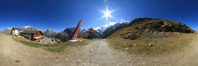