Добавить любой RSS - источник (включая журнал LiveJournal) в свою ленту друзей вы можете на странице синдикации.
Исходная информация - http://www.360cities.net/. Данный дневник сформирован из открытого RSS-источника по адресу http://www.360cities.net/rss/rss.xml, и дополняется в соответствии с дополнением данного источника. Он может не соответствовать содержимому оригинальной страницы. Трансляция создана автоматически по запросу читателей этой RSS ленты. По всем вопросам о работе данного сервиса обращаться со страницы контактной информации.[Обновить трансляцию]
360° panorama by Chris Yaxley. Click the image to open the interactive version.
An early and foggy morning on Cromer beach on the North Norfolk coast. This area of the beach is where the local fisherman moor their traditional fishing boats.
360° panorama by Chris Yaxley. Click the image to open the interactive version.
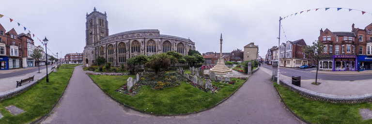
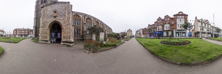
The historical and traditional church of St Peter and St Paul in the seaside town of Cromer on the North Norfolk Coast. Captured on a dull and overcast morning.
360° panorama by Chris Yaxley. Click the image to open the interactive version.
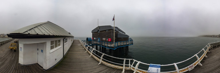
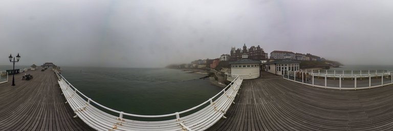
The RNLI lifeboat station in Cromer is ideally situated at then end of the Victorian pier giving it quick access to the North Sea. Captured on an overcast and foggy morning.
360° panorama by Chris Yaxley. Click the image to open the interactive version.
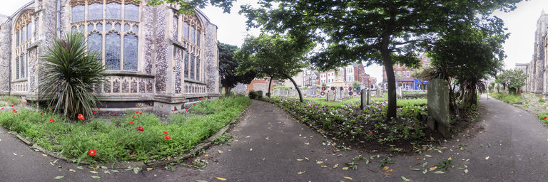
The church yard of the Church of St Peter and St Paul in the seaside town of Cromer on the North Norfolk coast. The grounds of this church yard is stunning and full of manicured lawns and pretty flowers.
360° panorama by Chris Yaxley. Click the image to open the interactive version.
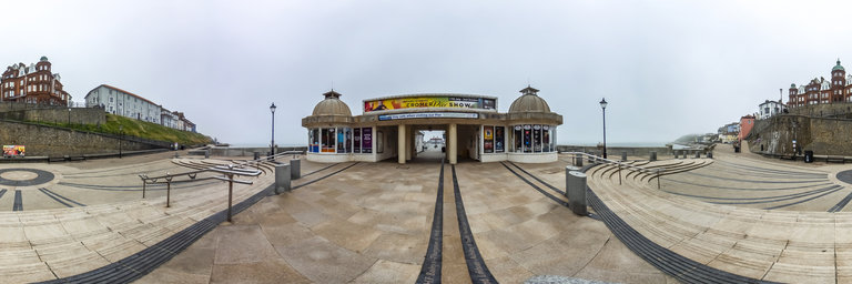
The grand entrance to the Victorian pier in the seaside town of Cromer on the North Norfolk coast. Early doors on a foggy morning this spot is very quiet. In the height of summer this spot is full of tourists and very busy.
360° panorama by Chris Yaxley. Click the image to open the interactive version.
A view along the public footpath through the church yard of the Church of St Peter ans St Paul, in the seaside town of Cromer. With its manicured lawns, colorful flower beds and stunning architecture Cromer church yard is well worth a visit.
360° panorama by Chris Yaxley. Click the image to open the interactive version.
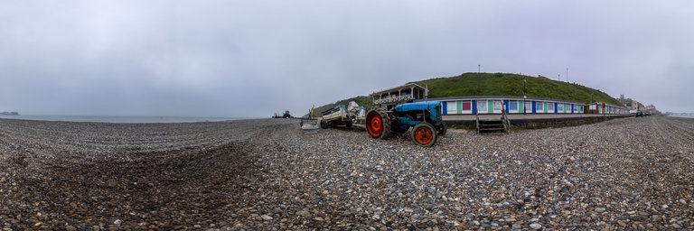
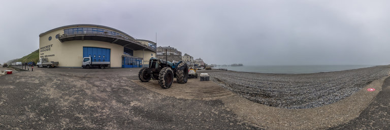
A traditional crab fishing boat and tractor, used to take the boat to and from the sea, parked up on Comer beach on the North Norfolk coast. Captured early on a dull and foggy morning before the crowds descended on the promenade.
360° panorama by Chris Yaxley. Click the image to open the interactive version.
A tractor used to take the crab fishing boats to and from the North sea parked up outside the RNLI Museum on the promenade in the seaside town of Cromer on the North Norfolk Coast. Captured early on a dull and foggy morning.
360° panorama by Chris Yaxley. Click the image to open the interactive version.
Looking back at the seaside town of Cromer on the North Norfolk coast. Captured from the Victorian pier early morning in the fog.
360° panorama by Chris Yaxley. Click the image to open the interactive version.
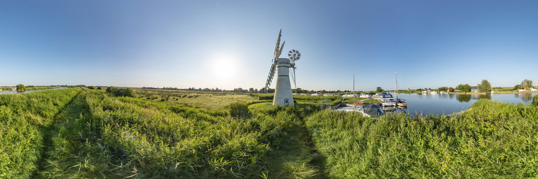
The historic and traditional white windmill at the mouth of Thurne Dyke just off the main River Thurne in the Norfolk Broads. This mill, not surprisingly known as Thurne Mill, was once a fully operational drainage mill. It no longer works and serves as a tourist attraction. Captured early morning just after sunrise
360° panorama by Ole Achilles. Click the image to open the interactive version.
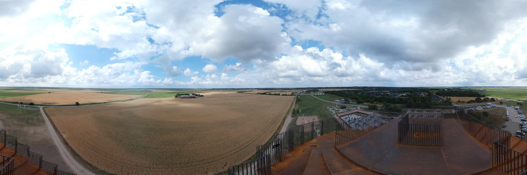
The Marsh Tower, the 25 meter high lookout tower, was designed by the world-renowned architects from Bjarke Ingels Group (BIG). The tower's unique construction is based on nature and human DNA. With a height of 36 meters above sea level, it is the spiral tower and attraction that will be visible at many kilometers distance. With a unique location in Hjemsted by Skaerbaek, you will from the "Marsh Tower" have a ticket to unique nature experiences from the front row, with a view of the Marsh and the Wadden Sea National Park, which is on the UNESCO World Heritage List and known for its unique nature and spectacular wildlife. In good weather conditions you can see all the way to Esbjerg, Herring and Romo from the large viewing platform.
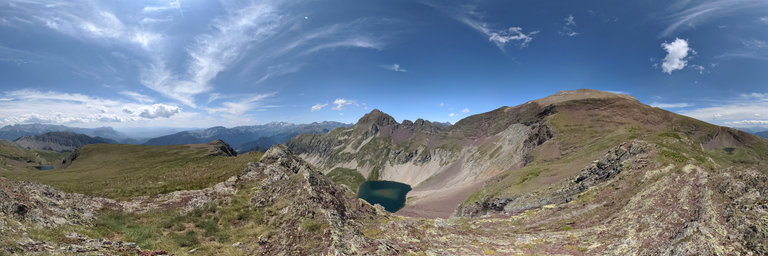
360° panorama by JL_Piedrafita. Click the image to open the interactive version.
En la pedregosa y escarpada vertiente oeste de Punta Suelza se abre un profundo y espectacular circo glaciar de perfecta forma redonda. Su fondo est'a ocupado por el bello ib'on del Cao (o Cau) retenido por un umbral morr'enico, ondulado y cubierto de praderas, y rodeado de una corona de grandes canchales multicolores que se han ido desprendiendo de las paredes del circo a lo largo del tiempo postglaciar. Punta Fulsa es el relieve m'as atrevido. Algo m'as al sur y en circos de relieve m'as dulcificado los dos ibones de Barleto aparecen rodeados de praderas alpinas y canchales bastante m'as fijados por plantas especializadas en colonizar pedrizas llev'andolas de flores en el momento adecuado.