Добавить любой RSS - источник (включая журнал LiveJournal) в свою ленту друзей вы можете на странице синдикации.
Исходная информация - http://www.360cities.net/. Данный дневник сформирован из открытого RSS-источника по адресу http://www.360cities.net/rss/rss.xml, и дополняется в соответствии с дополнением данного источника. Он может не соответствовать содержимому оригинальной страницы. Трансляция создана автоматически по запросу читателей этой RSS ленты. По всем вопросам о работе данного сервиса обращаться со страницы контактной информации.[Обновить трансляцию]
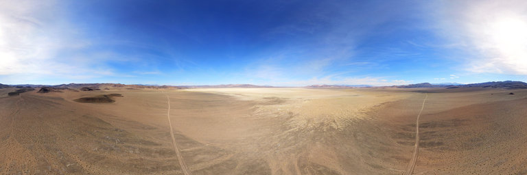
360° panorama by William l. Click the image to open the interactive version.
Aerial view of the Columbus Salt Marsh, Nevada. Eons of alluvial deposits have eroded from the Candelaria Hills, carried by flash flooding events. Here you can see the different color tones of rock from the hills.
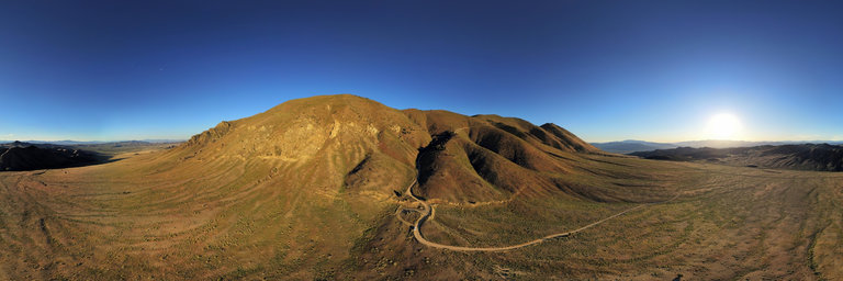
360° panorama by William l. Click the image to open the interactive version.
Fairview Peak is located near to Highway 50 between Fallon & Austin, Nevada. On December 16, 1954 at 3:08am, a magnitude 7.3 earthquake struck about seven miles west of here. It was part of a series of six earthquakes & two aftershocks felt between July & December. The result of the December earthquake exposed a 50-mile long fault along the base of Fairview Peak & over in the Stillwater Range, uplifting the mountains six feet in a matter of moments. In other areas, the land rose an abrupt 20 feet. Here nearly 70 years later one can still see the fault line exposed below Fairview Peak.
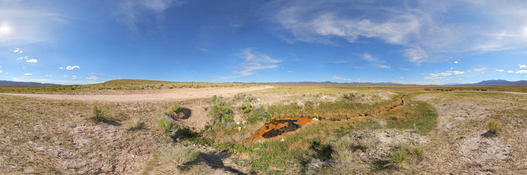
360° panorama by William l. Click the image to open the interactive version.
Potts Ranch Hot Spring bubbles & emerges here in the Monitor Valley of central Nevada at 113*F. A soaking tub is located at one of the other sources nearby. Water feeds into the green meadow in the distance where livestock graze. Look in that direction to also see the low white travertine hill marking Diana's Punchbowl.
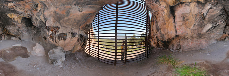
360° panorama by William l. Click the image to open the interactive version.
Toquima Cave is located near Pete's Summit south east of Austin, Nevada. It sits in a rock face w/ a perfect view to the east & shelter from the blazing sun, visible from the main forest service road. Inside it features many colorful pictographs on both sides of the wall & a charcoaled ceiling from fire. From the Travel Nevada website: The captivating Toquima Cave is not far from the geographic center of Nevada, just south of the notorious Loneliest Road in America. Burrowed in the Toquima Range in the Humboldt-Toiyabe National Forest, this extraordinarily historic site holds massive cultural importance to American Indians, particularly the Western Shoshone who once densely populated the area thousands of years ago. This intensely sacred rock shelter was utilized by American Indians as a temporary dwelling between 3,000 and 1,500 years ago. Very few artifacts were uncovered from the cave, as it was only occupied for a short period of time. While relics from this prehistoric period are few and far between, the Natives left quite the enigmatic footprint inside the cave: a large number of pictographs on the north and south walls. Pictographs, not to be confused with petroglyphs, are images drawn or painted on a rock face. Petroglyphs on the other hand, are created by carving or engraving images onto a rock surface. The easily identifiable pictographs were painted in white, red, yellow and black pigments and seemingly applied by finger painting. Over 300 independent motifs can be spotted, and although determined to be non-representational, the images are quite fascinating, nonetheless. According to experts, these Natives illustrated abstract paintings, incorporating long rows of tick-marks while also heavily implementing circular and triangular shapes. While this is the official determination of this significant archeological site, to an uninformed visitor, the shapes start to take on recognizable forms, like deer or buffalo. As one of many pictograph sites in Nevada, Toquima Cave and the surrounding 40 acres were added to the National Register of Historic Places in 2002. When arriving at the site, enter the Toquima Cave Campground and hike the short 1/2 mile up to the entrance of the Cave. To protect this tremendous history, the cave is fenced off in order to keep visitors at a respectful distance, and access in the actual interior is very limited. Native peoples consider this an important sacred site and continue to hold modern day ceremonial activities at Toquima Cave. Source: https://travelnevada.com/caves/toquima-cave/
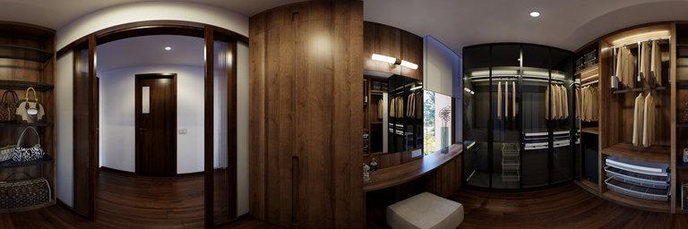
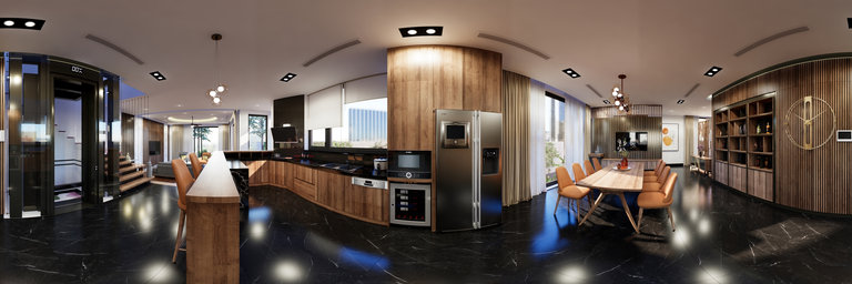
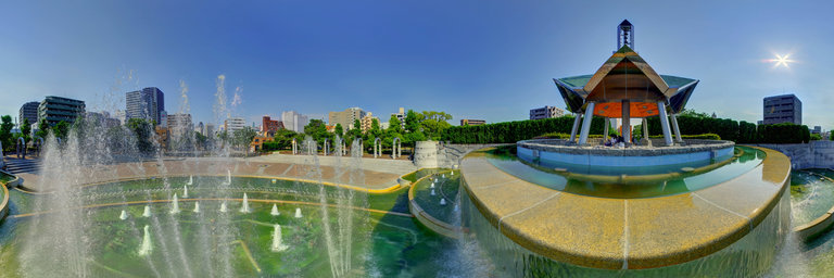
360° panorama by Andrew Bodrov. Click the image to open the interactive version.
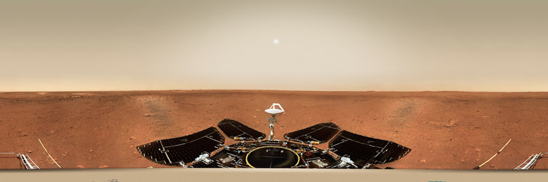
China National Space Administration Tianwen-1 interplanetary mission (Image credit: CNSA) Sol 27: Landing site panorama The panoramic view of the landing site is made by the navigation terrain camera on the mast of the Zhurong rover, when the rover has not left the landing platform. The image shows that the terrain near the landing site is flat, and the Martian horizon can be seen in the distance. The abundance and size of the rocks are consistent with expectations, indicating that the autonomous selection of the landing site and the implementation of hovering obstacle avoidance are effective. The Mars topography map is the first topography and geomorphology image map taken by the navigation terrain camera after the rover reaches the surface of Mars. Panoramas of Mars by NASA's Perseverance rover: http://www.360cities.net/sets/perseverance-mars Panoramas of Mars by NASA's Curiosity rover: http://www.360cities.net/sets/curiosity-mars
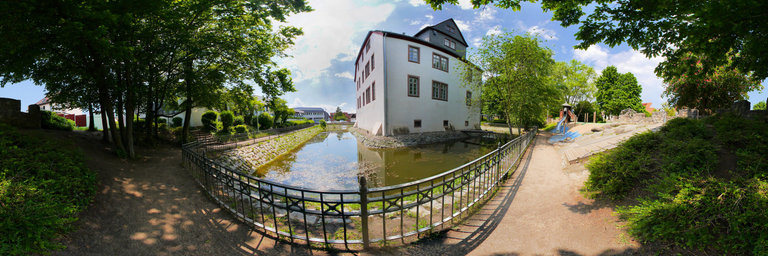
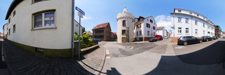
360° panorama by Bruce Hemming. Click the image to open the interactive version.
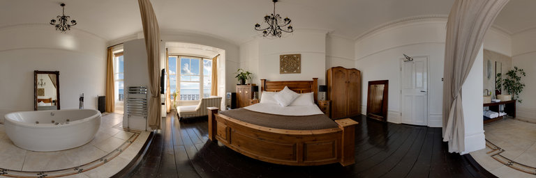
A grand early Victorian terraced house on the sea front at St Leonards has been turned into a boutique hotel with rooms themed on the continents of the world.