Добавить любой RSS - источник (включая журнал LiveJournal) в свою ленту друзей вы можете на странице синдикации.
Исходная информация - http://www.360cities.net/. Данный дневник сформирован из открытого RSS-источника по адресу http://www.360cities.net/rss/rss.xml, и дополняется в соответствии с дополнением данного источника. Он может не соответствовать содержимому оригинальной страницы. Трансляция создана автоматически по запросу читателей этой RSS ленты. По всем вопросам о работе данного сервиса обращаться со страницы контактной информации.[Обновить трансляцию]
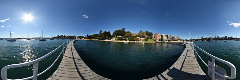
360° panorama by Kent Johnson. Click the image to open the interactive version.
A sunny day at Redleaf. Redleaf is the name of the house on the top of the hill, the pool used to be know by the same name. Murray Rose pool is a tidal swimming enclosure with a boardwalk and pontoons, open all year round. This picture was taken in July, winter in Sydney.. enough said!
360° panorama by William l. Click the image to open the interactive version.
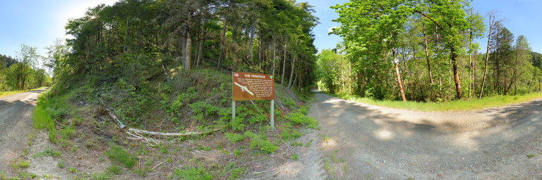
The China Ditch is a thirty mile long canal excavated by as many as two-hundred Chinese laborers from the spring of 1891 until the winter of 1894, located northeast of Myrtle Creek, Oregon. A company by the name of Myrtle Creek Consolidated Hydraulic Gold Mining and Manufacturing Company bought land, paid for the construction of the ditch, and obtained hydraulic giants to work the hills in North Myrtle Creek. In the summer of 1894, the company went out of business and lost everything. Thousands of dollars were lost by owners of stock in this company, and many felt that the construction of the ditch was just a decoration in an elaborate scam aimed at stock buyers. Today the ditch is on the National Register of Historic Places. A short section of the ditch is set aside for exploration by the public on what is known as the China Ditch Driving Loop. Four-thousand feet of the ditch is also open as a walking section (rustic, undeveloped) where visitors can take a trip back into the historic past of Oregon's gold mining history. Here along the auto loop road not far from the trail is a sign indicating the penstock, a long rusted pipe extending far up the hillside. Source: http://www.ohranger.com/china-ditch-automobile-loop/poi/china-ditch-automobile-loop
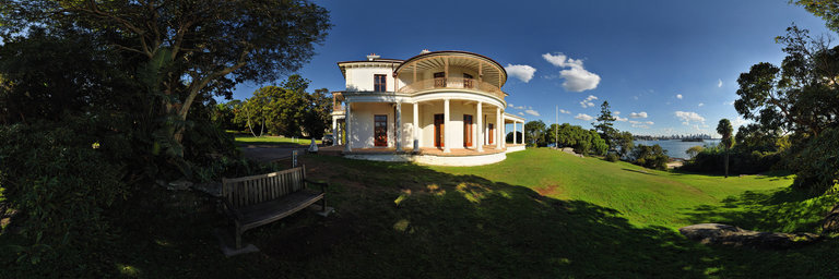
360° panorama by Kent Johnson. Click the image to open the interactive version.
Strickland House is a heritage-listed former residence designed by John F. Hilly and built from 1830 to 1858 by William Wentworth. It has commanding views of Sydney harbour looking west to the Sydney CBD, the harbour bridge and Sydney Opera House. The grounds are now part of Sydney Harbour national park and a heritage foreshore walk passes through the grounds.
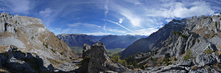
360° panorama by William l. Click the image to open the interactive version.
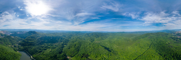
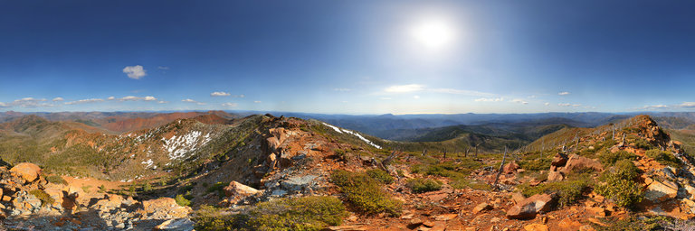
Gigapixel summit panorama from atop Vulcan Peak (elev. 4,655') in the west side of the Kalmiopsis Wilderness near Brookings, Oregon. Views of the bare (from the Biscuit Fire) peridotite red colored rocks south to Red Mountain & Chetco Peak. Distant views of the snowy Preston Peak area behind that, the Pacific Ocean to the west, & the Big Craggies & Collier Butte to the north. In 1941 a lookout tower was built here however it is now long gone. Gigapixel panorama (1.378 gigapixels), 274 photos, 52492x26246 pixels
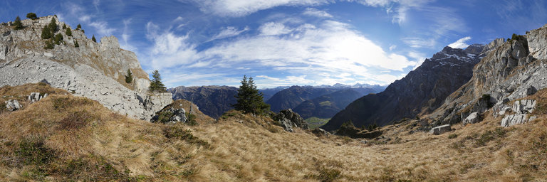
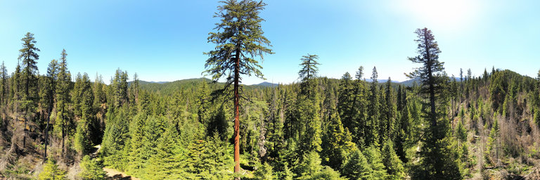
360° panorama by William l. Click the image to open the interactive version.
Aerial view about 150' up showing the tallest known sugar pine (pinus lambertiana) in Oregon near Tiller. It measures 255 feet in height & has a base diameter of 7.5 feet, estimated at 400 years old w/ cones up to 1.5 feet in length. Nearby is another tall sugar pine, though about 40 feet lower. It has often been cited as being the world's tallest though there have been other more recent discoveries. One such sugar pine in Yosemite was measured to be 14 feet taller before it died a few years back & another one discovered in 2015 in the same region registers 273 feet in height. Regardless, it is an impressive sight w/ the lowest branches about 150 feet up. Unfortunately in the year 2000, vandals came w/ a chainsaw & left a scar line along the base.
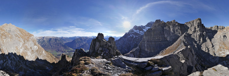
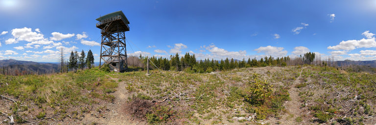
360° panorama by William l. Click the image to open the interactive version.
View from the top of Quail Prairie Mountain northeast of Brookings, Oregon. The peak was hit by the Chetco Bar Fire however the fire lookout survived. Here one can see towards Vulcan Peak as well as views of the ocean (from the lookout cab itself). The fire lookout was built in 1963, standing 41 feet in height. It in recent years has fallen into significant disrepair & vandalism, with the lower flight of stairs missing.