Добавить любой RSS - источник (включая журнал LiveJournal) в свою ленту друзей вы можете на странице синдикации.
Исходная информация - http://www.360cities.net/. Данный дневник сформирован из открытого RSS-источника по адресу http://www.360cities.net/rss/rss.xml, и дополняется в соответствии с дополнением данного источника. Он может не соответствовать содержимому оригинальной страницы. Трансляция создана автоматически по запросу читателей этой RSS ленты. По всем вопросам о работе данного сервиса обращаться со страницы контактной информации.[Обновить трансляцию]
360° panorama by Andrew Bodrov. Click the image to open the interactive version.
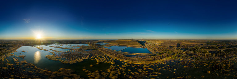
Oil shale is a strategic energy resource that constitutes about 4% of Estonia's gross domestic product. The oil shale industry in Estonia is one of the most developed in the world. In 2012, the country's oil shale industry employed 6,500 people – about 1% of the national workforce. Of all the oil shale fired power stations in the world, the two largest are in this country. In 2012, 70% of mined oil shale was used for electricity generation, accounting for about 85% of Estonia's total electricity production. A smaller proportion of the mined oil shale is used to produce shale oil, a type of synthetic oil extracted from shale by pyrolysis, which is sufficient to keep Estonia as the second largest shale oil producer in the world after China. In addition, oil shale and its products are used in Estonia for district heating and as a feedstock material for the cement industry. Source: Wikipedia
360° panorama by Lucio Virzi'. Click the image to open the interactive version.
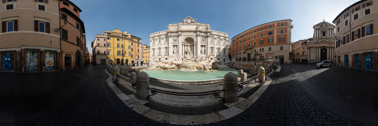
This is the masterpiece of Barocco, one of the majestic examples of monumental fountain. I took this photo during the Covid-19 quarantine, while I was around the city on assignment for a reportage. You will never see again another photo without tourists and citizens.
360° panorama by Andrew Bodrov. Click the image to open the interactive version.
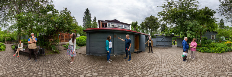
Konstantin Eduardovich Tsiolkovsky was a Russian and Soviet rocket scientist and pioneer of the astronautic theory. Along with the French Robert Esnault-Pelterie, the German-Romanian Hermann Oberth and the American Robert H. Goddard, he is considered to be one of the founding fathers of modern rocketry and astronautics. His works later inspired leading Soviet rocket engineers such as Sergei Korolev and Valentin Glushko and contributed to the success of the Soviet space program. In the outskirts of Kaluga is the wooden house in which Tsiolkovsky lived. In 1936, one year after his death, this house was turned into a memorial house museum and is now part of the museum organization. The museum also incorporates a scientific effort to study the life and works of Konstantin Tsiolkovsky. Source: Wikipedia
360° panorama by Simona Bartolomei. Click the image to open the interactive version.
The Terrible Dogfish is a sea-monster that appears in Carlo Collodi's 1883 book "Le avventure di Pinocchio". It is described as being larger than a five-story building, a kilometer long and sporting three rows of teeth in a very big mouth.
360° panorama by Melkan Bassil. Click the image to open the interactive version.
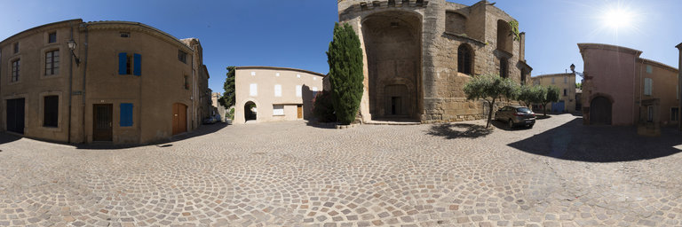
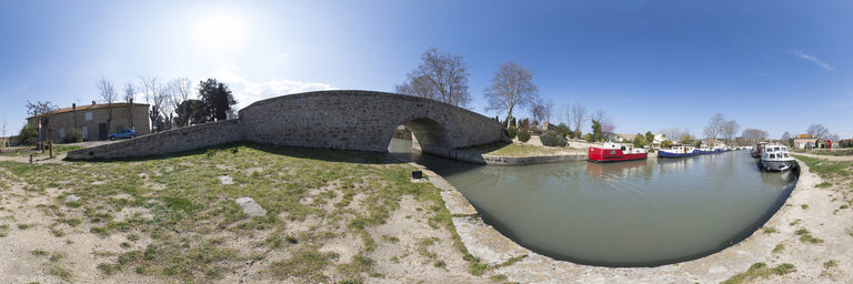
Le village de Montels est b^ati sur une ancienne terrasse marine au bord de l’'Etang de Capestang. Son nom vient de cette implantation, Montels : petite montagne. Ce golfe de mer s’est colmat'e et les ing'enieurs de la Via Domitia l’ont franchi par un syst`eme de digues et de ponts. L’'eglise du XIIe si`ecle constitue un bel exemple de l’art roman.
360° panorama by Melkan Bassil. Click the image to open the interactive version.
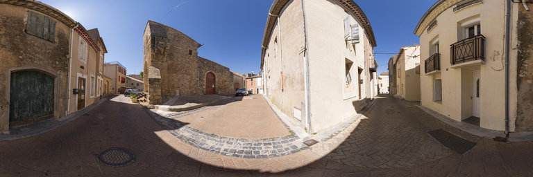
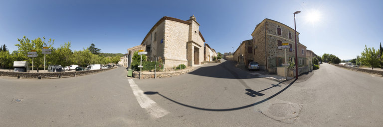
Situ'e dans un 'ecrin de verdure, Cruzy est un village languedocien caract'eristique. Il poss`ede un petit centre historique, le castrum, autrefois entour'e de remparts dont la disposition est quasi circulaire. Un clocher majestueux surplombe l’'eglise fortifi'ee Sainte-Eulalie. Les remparts sont bord'es de maisons construites entre le XVe si`ecle et le XIXe si`ecle. La commune poss`ede un mus'ee avec des pi`eces arch'eologiques particuli`erement int'eressantes.
360° panorama by Melkan Bassil. Click the image to open the interactive version.
Creissan est mentionn'e pour la premi`ere fois dans une s'erie de chartes du Xe si`ecle. D`es 952, le propri'etaire de l’alleu vend ses biens au vicomte de Narbonne, qui le c`ede en 959, `a l’archev^eque Aymeric de Narbonne. `a sa mort en 977, les moines du chapitre de la Cath'edrale de Narbonne deviennent les ma^itres de l’alleu. En 1095, avec le d'esastre des croisades, les habitants d'esignent leurs premiers consuls. Le village reste une possession des archev^eques et du chapitre de la Cath'edrale de Narbonne, jusqu’`a la R'evolution. Le patrimoine de Creissan compte deux sites majeurs m'edi'evaux : un ch^ateau et une 'eglise. Il est aussi int'eressant du point de vue g'eologique avec la pr'esence de gypse, bauxite, marbres, gr`es polypiers et hu^itres fossiles.
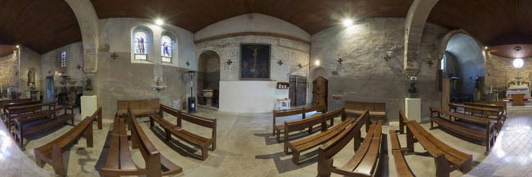
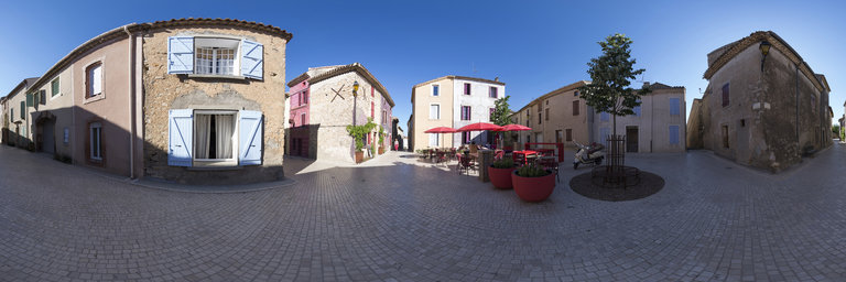
360° panorama by Melkan Bassil. Click the image to open the interactive version.
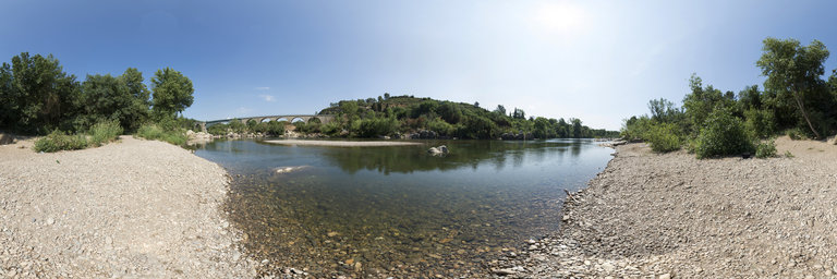
Le village est situ'e entre les vignes, les montagnes et le fleuve Orb, blotti `a flanc de colline, il est l’une des plus anciennes cit'es du Languedoc. De nombreuses traces d’'epoques diverses sont encore aujourd’hui apparentes : 'epoques pr'ehistorique, wisigothique, sarrasine, romaine, m'edi'evale, moderne et contemporaine. Le site est aussi remarquable par ses ressources naturelles : marbre, gr`es, argile…
360° panorama by Melkan Bassil. Click the image to open the interactive version.
Ce village est fond'e au IXe si`ecle par des moines b'en'edictins. Il est alors compos'e de cinq mas qui portent les noms propres des familles qui les occup`erent. Aujourd’hui, les maisons de C'ebazan sont construites en pierres de tuf aux couleurs vives. Le patrimoine t'emoigne d’un riche pass'e avec des vestiges pr'ehistoriques, romains, pal'eochr'etiens mais aussi ceux de l’histoire plus r'ecente des XIXe et XXe si`ecles.
360° panorama by Melkan Bassil. Click the image to open the interactive version.
Cazedarnes-le-haut et Cazedarnes-le-bas 'etaient autrefois deux hameaux qui faisaient partie de la commune de Cessenon-sur-Orb. En 1850, ils deviennent une commune. Le patrimoine du village est vari'e : des vestiges pr'ehistoriques et romains, des fontaines et des facades color'ees faconn'ees avec la terre locale. On y trouve aussi des 'el'ements remarquables comme l’Abbaye de Fontcaude, l’'Eglise Saint-Amand avec les fresques de Nicolas Greshny et le Chemin de Saint-Jacques-de-Compostelle.
360° panorama by Melkan Bassil. Click the image to open the interactive version.
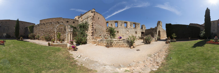
Capestang doit son nom `a sa situation « au cap de l’'etang ». Situ'ee sur le trac'e de la Via Domitia, la commune b'en'eficiait de la pr'esence des salins, puis de celle du Canal du Midi. Son patrimoine est particuli`erement riche : la Coll'egiale Saint-'etienne du XIIe si`ecle, l’ancien ch^ateau de l’archev^eque de Narbonne avec ses plafonds peints, le Canal du Midi, l’'etang de Capestang et le Chemin de Saint-Jacques-de-Compostelle.
360° panorama by Melkan Bassil. Click the image to open the interactive version.
La commune est constitu'ee de deux hameaux : Babeau, o`u se trouve la mairie, et Bouldoux sur le ruisseau de L’Illouvre. On y trouve des vestiges romains, une 'eglise, le hameau du Cauduro ainsi que le centre de nature et de d'ecouverte Malibert.
360° panorama by Melkan Bassil. Click the image to open the interactive version.
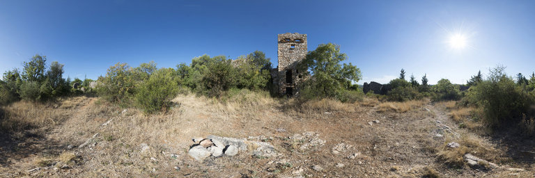
Village perch'e entre les vignes et la garrigue, visible au loin gr^ace sa tour m'edi'evale, Assigan pr'esente une grande richesse arch'eologique (abris sous roche, ancien chemin romain, dolmens). Dot'e aussi d’un patrimoine religieux, on peut y voir les ruines d’une chapelle du IVe ou Ve si`ecle et une 'eglise du XVIIe si`ecle. Aujourd’hui, Assignan se d'eveloppe autour d’un projet public-priv'e de « village oenotouristique ».
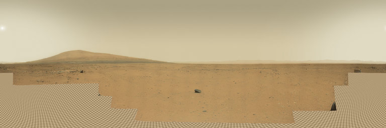
360° panorama by Andrew Bodrov. Click the image to open the interactive version.
NASA's Mars Exploration Program (Image credit: NASA/JPL-Caltech/MSSS) Sol 375: Going Over the Hill The images for panorama obtained by the rover's 34-millimeter Mast Camera. The mosaic, which stretches about 30,000 pixels width, includes 97 images taken on Sol 375 (August 25, 2013). The Sol 374 drive, including the AutoNav portion, went very well, so an even longer drive is planned for Sol 376. For the first time AutoNav will be used to drive 10 meters over the hill, or beyond the area imaged in stereo by the Navcams after the Sol 374 drive. If the AutoNav software continues to perform well, allowing the rover to drive into areas that cannot be evaluated in advance, longer AutoNav drives will be allowed. Written by Ken HerkenhoffUSGS Scientist Other panoramas of Mars by Curiosity rover: http://www.360cities.net/sets/curiosity-mars
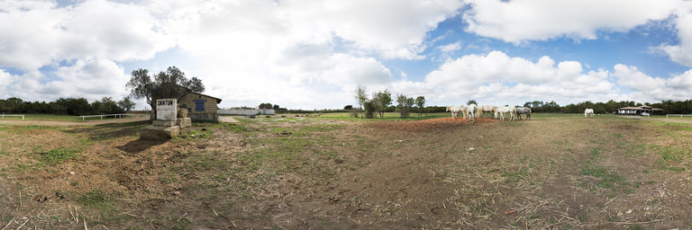
360° panorama by Melkan Bassil. Click the image to open the interactive version.
Danton 'etait un c'el`ebre biu ou taureau de la commune de Mauguio-Carnon