Добавить любой RSS - источник (включая журнал LiveJournal) в свою ленту друзей вы можете на странице синдикации.
Исходная информация - http://www.360cities.net/. Данный дневник сформирован из открытого RSS-источника по адресу http://www.360cities.net/rss/rss.xml, и дополняется в соответствии с дополнением данного источника. Он может не соответствовать содержимому оригинальной страницы. Трансляция создана автоматически по запросу читателей этой RSS ленты. По всем вопросам о работе данного сервиса обращаться со страницы контактной информации.[Обновить трансляцию]
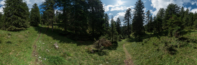
360° panorama by Carl W. von Einem. Click the image to open the interactive version.
Coming from Mittenwald via the relatively low summit of Gr"unkopf I follow what is now known as the "French Path" (in German Franzosensteig) in direction to Leutasch valley. In 1805 Napoleon's French troops actually used this narrow path to bypass the nearby fortification close to Scharnitz (see also my "Porta Claudia" panorama) and surprise the Austrian troops still busy looking in the wrong direction.
360° panorama by William l. Click the image to open the interactive version.
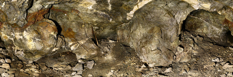
Inside one of the larger adits at the Indian Girl Mine near Hornbrook, California. A former gold mine, there are many surface diggings & rock walls outside as well as small openings to mines & prospects, this opening leading to just over 100 feet inside. Within the mines, gold-bearing quartz veins are hosted in native greenstone. Ceiling height here is about nine feet however parts of this adit involve some crawling (including the entrance).
360° panorama by Gary Davies. Click the image to open the interactive version.
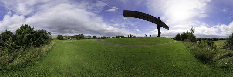
The Angel of the North is a large metal sculpture created by Antony Gormley in 1998. It stands 20 metres high and has a 54 metre wingspan. It is claimed to be viewed by someone every second, primarily due to its location next to the busy A1 dual carriageway.
360° panorama by Gary Davies. Click the image to open the interactive version.
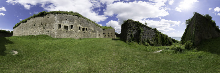
The Drop Redoubt is a derelict artillery fort on the Western Heights cliffs, overlooking Dover. It was built during the Napoleonic Wars to guard against French invasion. Its strategic location at England’s closest point to continental Europe also saw it used in a defensive role during both World Wars. The name is derived from ‘The Drop’, which is the name formerly given to the area in which it is situated, with ‘Redoubt’ meaning detached fort.
360° panorama by Gary Davies. Click the image to open the interactive version.
The Drop Redoubt is a derelict artillery fort on the Western Heights cliffs, overlooking Dover. It was built during the Napoleonic Wars to guard against French invasion. Its strategic location at England’s closest point to continental Europe also saw it used in a defensive role during both World Wars. The name is derived from ‘The Drop’, which is the name formerly given to the area in which it is situated, with ‘Redoubt’ meaning detached fort.